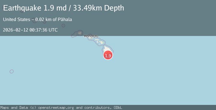
Earthquake 21 km SE of Pāhala, Hawaii
Thu, 12 Feb 2026 00:37:36 GMT
Time1 week ago
Location
19.0438, -155.3572
Depth
33.5 KM
Event Summary
A 1.9 magnitude earthquake struck on 21 km SE of Pāhala, Hawaii, at Thu, 12 Feb 2026 00:37:36 GMT. Depth: 33.4900016784668km. Reviewed by USGS seismologists, this minor quake occurred at a magnitude type of md.
Magnitude
1.9
md
Source
USGS
Intensity
-
Agency Reports
1 Sources| Source | Magnitude | Depth | Time |
|---|---|---|---|
| USGSPrimary | 1.9 | 33 km | 1 week ago |
Earthquake Details
AutomaticEvent IDusgs_hv74897817
Tsunami PotentialNo
Magnitude Typemd
Nearest Places
- Papau Seamount12.5 km
- Ahole Heiau14.0 km
- Palima Point15.3 km
- Waioala Spring15.3 km
- Pueo15.5 km
Comments
Join the discussion about this event.
Latest Earthquakes
3.2Mag
Talaud Islands, Indonesia
Time2 hours ago
Depth10.00 km
SourceBMKG
1.9Mag
Poland
Time2 hours ago
Depth10.01 km
SourceVYT (Automatic)
1.6Mag
10 km W of Pine Valley, CA
Time2 hours ago
Depth16.88 km
SourceUSGS (Automatic)
2.4Mag
West Papua Region, Indonesia
Time2 hours ago
Depth10.00 km
SourceBMKG
4.5Mag
Tarapaca, Chile
Time2 hours ago
Depth128.42 km
SourceVYT (Automatic)
Nearby Earthquakes
1.7Mag
21 km SE of Pāhala, Hawaii
Time3 weeks ago
Depth34.15 km
SourceUSGS (Automatic)
1.9Mag
21 km SE of Pāhala, Hawaii
Time1 week ago
Depth30.18 km
SourceUSGS (Automatic)
1.8Mag
21 km SE of Pāhala, Hawaii
Time2 weeks ago
Depth40.82 km
SourceUSGS (Automatic)
2.4Mag
ISLAND OF HAWAII, HAWAII
Time6 days ago
Depth33.40 km
SourceHV (Automatic)
2.5Mag
22 km SE of Pāhala, Hawaii
Time1 week ago
Depth35.13 km
SourceUSGS (Automatic)