Earthquake 14 km NE of Pāhala, Hawaii
Fri, 13 Feb 2026 07:01:42 GMT
Time6 days ago
Location
19.2917, -155.3820
Depth
2.7 KM
Event Summary
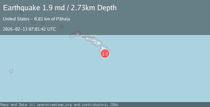
A 1.9 magnitude earthquake struck on 14 km NE of Pāhala, Hawaii, at Fri, 13 Feb 2026 07:01:42 GMT. Depth: 2.73000001907349km. Reviewed by USGS seismologists, this minor quake occurred at a magnitude type of md.
Magnitude
1.9
md
Source
USGS
Intensity
-
Agency Reports
1 Sources| Source | Magnitude | Depth | Time |
|---|---|---|---|
| USGSPrimary | 1.9 | 3 km | 6 days ago |
Earthquake Details
AutomaticEvent IDusgs_hv74898482
Tsunami PotentialNo
Magnitude Typemd
Nearest Places
- Pu‘ukou1.1 km
- Kealaalea Hills1.5 km
- Yellow Cone1.6 km
- Kīpuka Pepeiao2.4 km
- Kamakai‘a Hills2.6 km
Comments
Join the discussion about this event.
Latest Earthquakes
0.6Mag
Southern Alaska
Time1 minute ago
Depth0.00 km
SourceVYT (Automatic)
3.2Mag
Northern Molucca Sea
Time3 minutes ago
Depth78.57 km
SourceBMKG
1.3Mag
Oregon
Time3 minutes ago
Depth0.00 km
SourceVYT (Automatic)
2.0Mag
Tarapaca, Chile
Time6 minutes ago
Depth104.13 km
SourceVYT (Automatic)
2.0Mag
Tarapaca, Chile
Time8 minutes ago
Depth120.97 km
SourceVYT (Automatic)
Nearby Earthquakes
1.8Mag
14 km NE of Pāhala, Hawaii
Time1 week ago
Depth3.50 km
SourceUSGS (Automatic)
2.3Mag
ISLAND OF HAWAII, HAWAII
Time1 month ago
Depth30.30 km
SourceHV (Automatic)
2.0Mag
ISLAND OF HAWAII, HAWAII
Time1 month ago
Depth28.30 km
SourceHV (Automatic)
2.0Mag
ISLAND OF HAWAII, HAWAII
Time3 weeks ago
Depth30.30 km
SourceHV (Automatic)
3.0Mag
ISLAND OF HAWAII, HAWAII
Time3 years ago
Depth35.00 km
SourceNEIC (Automatic)