Earthquake 16 km NNW of Lopez Point, CA
Tue, 03 Feb 2026 23:55:06 GMT
Time17 hours ago
Location
36.1555, -121.6155
Depth
15.8 KM
Event Summary
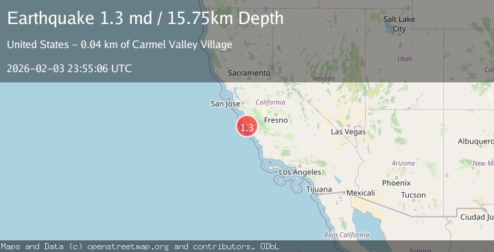
A 1.3 magnitude earthquake struck on 16 km NNW of Lopez Point, CA, at Tue, 03 Feb 2026 23:55:06 GMT. Depth: 15.75km. Reviewed by USGS seismologists, this minor quake occurred at a magnitude type of md.
Magnitude
1.3
md
Source
USGS
Intensity
-
Agency Reports
1 Sources| Source | Magnitude | Depth | Time |
|---|---|---|---|
| USGSPrimary | 1.3 | 16 km | 17 hours ago |
Earthquake Details
AutomaticEvent IDusgs_nc75307967
Tsunami PotentialNo
Magnitude Typemd
Nearest Places
- Upper Higgins Campground2.0 km
- Marble Peak2.2 km
- Pelon Campground2.3 km
- Indian Valley Campground2.4 km
- Indian Valley2.8 km
Comments
Join the discussion about this event.
Latest Earthquakes
0.6Mag
SWITZERLAND
Time10 hours ago
Depth1.60 km
SourceETHZ (Automatic)
2.5Mag
Sumba Region, Indonesia
Time10 hours ago
Depth61.17 km
SourceBMKG (Automatic)
1.9Mag
4 km SE of San Ramon, CA
Time10 hours ago
Depth8.44 km
SourceUSGS (Automatic)
3.0Mag
WESTERN AUSTRALIA
Time10 hours ago
Depth10.00 km
SourceAUST (Automatic)
3.5Mag
SOUTH ISLAND OF NEW ZEALAND
Time11 hours ago
Depth36.80 km
SourceGNS (Automatic)
Nearby Earthquakes
1.3Mag
10 km SSW of San Lucas, CA
Time3 days ago
Depth7.14 km
SourceUSGS (Automatic)
1.9Mag
2 km SW of Pinnacles, CA
Time1 week ago
Depth4.25 km
SourceUSGS (Automatic)
1.3Mag
4 km SSE of Pinnacles, CA
Time1 day ago
Depth3.13 km
SourceUSGS (Automatic)
1.7Mag
4 km SE of Pinnacles, CA
Time1 week ago
Depth1.08 km
SourceUSGS (Automatic)
1.7Mag
2 km NW of Pinnacles, CA
Time5 days ago
Depth6.40 km
SourceUSGS (Automatic)