Earthquake 71 km W of Petrolia, CA
Thu, 12 Feb 2026 01:39:11 GMT
Time6 days ago
Location
40.4080, -125.1190
Depth
0.3 KM
Event Summary
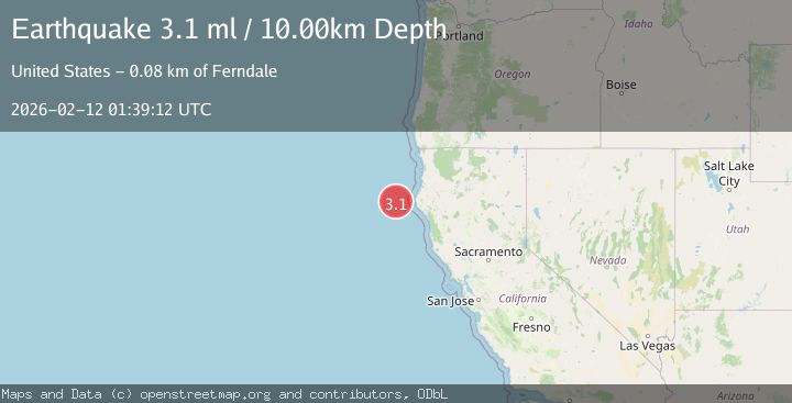
A 3.5 magnitude earthquake struck on 71 km W of Petrolia, CA, at Thu, 12 Feb 2026 01:39:11 GMT. Depth: 0.349999994039536km. Reviewed by USGS seismologists, this minor quake occurred at a magnitude type of ml.
Magnitude
3.5
ml
Source
USGS
Intensity
-
Agency Reports
3 Sources| Source | Magnitude | Depth | Time |
|---|---|---|---|
| USGSPrimary | 3.5 | 0 km | 6 days ago |
| NEIC | 3.3 | 10 km | 6 days ago |
| NC | 3.1 | 10 km | 6 days ago |
Earthquake Details
AutomaticEvent IDusgs_nc75312357
Tsunami PotentialNo
Magnitude Typeml
Nearest Places
- Gorda Escarpment6.1 km
- Eel Fan30.6 km
- Bear Valley32.3 km
- Mendocino Canyon43.6 km
- Blunts Reef Coast Guard Station52.5 km
Comments
Join the discussion about this event.
Latest Earthquakes
2.4Mag
Sulawesi, Indonesia
Time8 minutes ago
Depth4.26 km
SourceBMKG
2.2Mag
Northern Sumatra, Indonesia
Time12 minutes ago
Depth8.25 km
SourceBMKG
2.5Mag
CRETE, GREECE
Time19 minutes ago
Depth17.50 km
SourceNOA (Automatic)
2.5Mag
Tarapaca, Chile
Time22 minutes ago
Depth112.55 km
SourceVYT (Automatic)
2.0Mag
ALBANIA
Time23 minutes ago
Depth15.00 km
SourceIGEO (Automatic)
Nearby Earthquakes
3.0Mag
OFFSHORE NORTHERN CALIFORNIA
Time1 year ago
Depth10.00 km
SourceNEIC (Automatic)
3.0Mag
OFFSHORE NORTHERN CALIFORNIA
Time11 months ago
Depth8.20 km
SourceNC (Automatic)
3.0Mag
OFFSHORE NORTHERN CALIFORNIA
Time1 year ago
Depth10.00 km
SourceNC (Automatic)
3.2Mag
OFFSHORE NORTHERN CALIFORNIA
Time1 month ago
Depth3.20 km
SourceNC (Automatic)
5.0Mag
OFFSHORE NORTHERN CALIFORNIA
Time5 years ago
Depth10.00 km
SourceEMSC (Automatic)