Earthquake 6 km NW of The Geysers, CA
Thu, 12 Feb 2026 06:57:28 GMT
Time6 days ago
Location
38.8145, -122.8037
Depth
2.5 KM
Event Summary
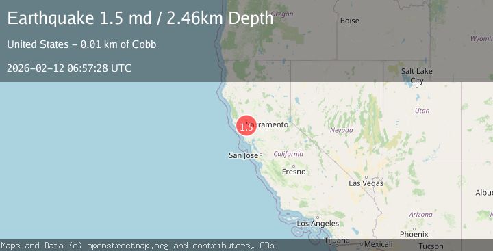
A 1.5 magnitude earthquake struck on 6 km NW of The Geysers, CA, at Thu, 12 Feb 2026 06:57:28 GMT. Depth: 2.46000003814697km. Reviewed by USGS seismologists, this minor quake occurred at a magnitude type of md.
Magnitude
1.5
md
Source
USGS
Intensity
-
Agency Reports
1 Sources| Source | Magnitude | Depth | Time |
|---|---|---|---|
| USGSPrimary | 1.5 | 2 km | 6 days ago |
Earthquake Details
AutomaticEvent IDusgs_nc75312512
Tsunami PotentialNo
Magnitude Typemd
Nearest Places
- Geyser Canyon1.6 km
- Geysers Resort1.8 km
- Bear Canyon1.8 km
- Cobb Creek2.6 km
- Coldwater Canyon2.7 km
Comments
Join the discussion about this event.
Latest Earthquakes
1.8Mag
Kodiak Island region, Alaska
Time6 hours ago
Depth7.20 km
SourceVYT (Automatic)
2.3Mag
northern Alaska
Time6 hours ago
Depth0.00 km
SourceVYT (Automatic)
4.3Mag
Antofagasta, Chile
Time6 hours ago
Depth131.35 km
SourceVYT (Automatic)
1.8Mag
Kenai Peninsula, Alaska
Time6 hours ago
Depth42.24 km
SourceVYT (Automatic)
1.7Mag
Central Alaska
Time6 hours ago
Depth196.04 km
SourceVYT (Automatic)
Nearby Earthquakes
0.7Mag
6 km NW of The Geysers, CA
Time6 days ago
Depth2.05 km
SourceUSGS (Automatic)
0.8Mag
6 km NW of The Geysers, CA
Time6 days ago
Depth2.37 km
SourceUSGS (Automatic)
1.1Mag
6 km NW of The Geysers, CA
Time6 days ago
Depth2.65 km
SourceUSGS (Automatic)
1.3Mag
6 km NW of The Geysers, CA
Time6 days ago
Depth2.28 km
SourceUSGS (Automatic)
0.8Mag
6 km NW of The Geysers, CA
Time3 days ago
Depth2.15 km
SourceUSGS (Automatic)