Earthquake 7 km NW of The Geysers, CA
Thu, 12 Feb 2026 17:25:16 GMT
Time1 week ago
Location
38.8265, -122.8143
Depth
2.1 KM
Event Summary
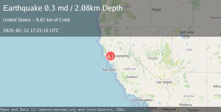
A 0.3 magnitude earthquake struck on 7 km NW of The Geysers, CA, at Thu, 12 Feb 2026 17:25:16 GMT. Depth: 2.07999992370605km. Reviewed by USGS seismologists, this minor quake occurred at a magnitude type of md.
Magnitude
0.3
md
Source
USGS
Intensity
-
Agency Reports
1 Sources| Source | Magnitude | Depth | Time |
|---|---|---|---|
| USGSPrimary | 0.3 | 2 km | 1 week ago |
Earthquake Details
AutomaticEvent IDusgs_nc75312777
Tsunami PotentialNo
Magnitude Typemd
Nearest Places
- Bear Canyon0.2 km
- Coldwater Canyon1.1 km
- Black Oaks1.6 km
- Caldwell Ranch2.1 km
- Caldwell Pines2.2 km
Comments
Join the discussion about this event.
Latest Earthquakes
2.2Mag
West Papua Region, Indonesia
Time18 minutes ago
Depth10.00 km
SourceBMKG
1.6Mag
PYRENEES
Time18 minutes ago
Depth0.00 km
SourceIGN (Automatic)
2.2Mag
Kenai Peninsula, Alaska
Time19 minutes ago
Depth47.00 km
SourceVYT (Automatic)
2.0Mag
Antofagasta, Chile
Time25 minutes ago
Depth23.32 km
SourceVYT (Automatic)
2.8Mag
Queensland, Australia
Time27 minutes ago
Depth714.23 km
SourceVYT (Automatic)
Nearby Earthquakes
0.8Mag
7 km NW of The Geysers, CA
Time2 hours ago
Depth1.94 km
SourceUSGS (Automatic)
2.1Mag
NORTHERN CALIFORNIA
Time1 month ago
Depth2.00 km
SourceNC (Automatic)
1.1Mag
8 km NW of The Geysers, CA
Time1 week ago
Depth1.89 km
SourceUSGS (Automatic)
2.1Mag
NORTHERN CALIFORNIA
Time1 month ago
Depth1.50 km
SourceNC (Automatic)
0.8Mag
8 km NW of The Geysers, CA
Time2 weeks ago
Depth2.16 km
SourceUSGS (Automatic)