Earthquake 31 km W of Petrolia, CA
Sat, 14 Feb 2026 12:30:42 GMT
Time4 days ago
Location
40.2988, -124.6543
Depth
0.2 KM
Event Summary
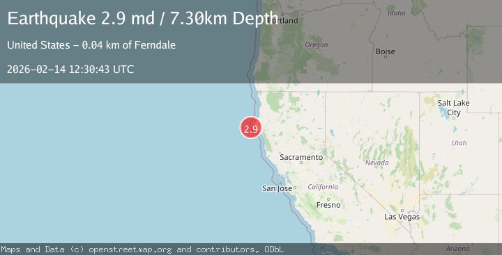
A 3.1 magnitude earthquake struck on 31 km W of Petrolia, CA, at Sat, 14 Feb 2026 12:30:42 GMT. Depth: 0.230000004172325km. Reviewed by USGS seismologists, this minor quake occurred at a magnitude type of ml.
Magnitude
3.1
ml
Source
USGS
Intensity
-
Agency Reports
2 Sources| Source | Magnitude | Depth | Time |
|---|---|---|---|
| USGSPrimary | 3.1 | 0 km | 4 days ago |
| NC | 2.9 | 7 km | 4 days ago |
Earthquake Details
AutomaticEvent IDusgs_nc75313697
Tsunami PotentialNo
Magnitude Typeml
Nearest Places
- Mendocino Canyon8.3 km
- Mattole Canyon17.4 km
- Mendocino Canyon18.9 km
- Blunts Reef Coast Guard Station19.9 km
- Blunts Reef Lightship (historical)21.1 km
Comments
Join the discussion about this event.
Latest Earthquakes
2.3Mag
Antofagasta, Chile
Time1 hour ago
Depth58.47 km
SourceVYT (Automatic)
1.4Mag
Southeastern Alaska
Time1 hour ago
Depth0.00 km
SourceVYT (Automatic)
1.8Mag
Southern Alaska
Time1 hour ago
Depth10.00 km
SourceVYT (Automatic)
2.0Mag
Southern Alaska
Time1 hour ago
Depth29.91 km
SourceVYT (Automatic)
2.6Mag
WESTERN TURKEY
Time1 hour ago
Depth5.00 km
SourceKOERI (Automatic)
Nearby Earthquakes
2.3Mag
OFFSHORE NORTHERN CALIFORNIA
Time1 month ago
Depth19.80 km
SourceNC (Automatic)
5.7Mag
OFFSHORE NORTHERN CALIFORNIA
Time11 years ago
Depth10.00 km
SourceEMSC (Automatic)
3.0Mag
OFFSHORE NORTHERN CALIFORNIA
Time8 months ago
Depth5.70 km
SourceNC (Automatic)
3.0Mag
OFFSHORE NORTHERN CALIFORNIA
Time1 year ago
Depth7.10 km
SourceNC (Automatic)
3.0Mag
OFFSHORE NORTHERN CALIFORNIA
Time4 years ago
Depth19.00 km
SourceNC (Automatic)