Earthquake 2 km N of The Geysers, CA
Mon, 16 Feb 2026 06:31:24 GMT
Time2 days ago
Location
38.7927, -122.7528
Depth
-0.5 KM
Event Summary
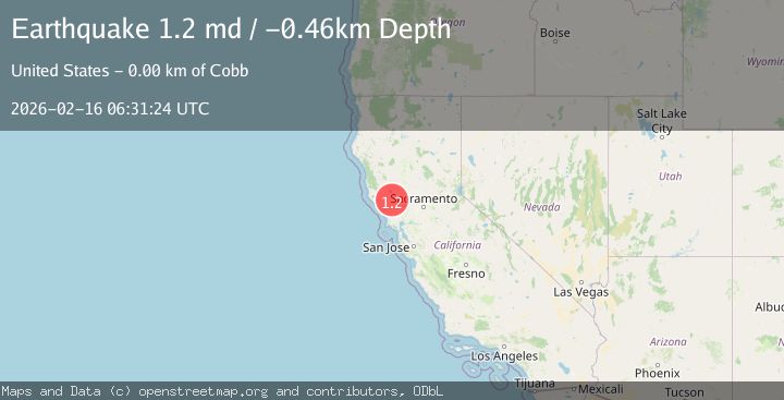
A 1.2 magnitude earthquake struck on 2 km N of The Geysers, CA, at Mon, 16 Feb 2026 06:31:24 GMT. Depth: -0.46000000834465km. Reviewed by USGS seismologists, this minor quake occurred at a magnitude type of md.
Magnitude
1.2
md
Source
USGS
Intensity
-
Agency Reports
1 Sources| Source | Magnitude | Depth | Time |
|---|---|---|---|
| USGSPrimary | 1.2 | -0 km | 2 days ago |
Earthquake Details
AutomaticEvent IDusgs_nc75314487
Tsunami PotentialNo
Magnitude Typemd
Nearest Places
- Smudgeo Number 1 Heliport0.9 km
- Burned Mountain1.8 km
- Cobb Mountain1.9 km
- Anderson-Bull Spring2.0 km
- The Geysers2.0 km
Comments
Join the discussion about this event.
Latest Earthquakes
1.8Mag
Central Alaska
Time14 hours ago
Depth0.00 km
SourceVYT (Automatic)
2.8Mag
WESTERN TURKEY
Time14 hours ago
Depth7.00 km
SourceAFAD (Automatic)
1.7Mag
Southern Alaska
Time14 hours ago
Depth31.01 km
SourceVYT (Automatic)
2.1Mag
HAWAII REGION, HAWAII
Time14 hours ago
Depth38.20 km
SourceHV (Automatic)
1.5Mag
41 km NW of Toyah, Texas
Time14 hours ago
Depth4.20 km
SourceUSGS (Automatic)
Nearby Earthquakes
2.1Mag
NORTHERN CALIFORNIA
Time4 days ago
Depth0.50 km
SourceNC (Automatic)
2.0Mag
NORTHERN CALIFORNIA
Time1 month ago
Depth0.80 km
SourceNC (Automatic)
1.0Mag
2 km N of The Geysers, CA
Time3 weeks ago
Depth1.54 km
SourceUSGS (Automatic)
1.1Mag
2 km N of The Geysers, CA
Time6 days ago
Depth-0.28 km
SourceUSGS (Automatic)
2.1Mag
NORTHERN CALIFORNIA
Time1 month ago
Depth0.40 km
SourceNC (Automatic)