Earthquake 2 km ESE of San Martin, CA
Tue, 17 Feb 2026 19:33:31 GMT
Time18 hours ago
Location
37.0800, -121.5882
Depth
23.3 KM
Event Summary
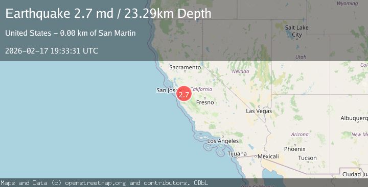
A 2.7 magnitude earthquake struck on 2 km ESE of San Martin, CA, at Tue, 17 Feb 2026 19:33:31 GMT. Depth: 23.2900009155273km. Reviewed by USGS seismologists, this minor quake occurred at a magnitude type of md.
Magnitude
2.7
md
Source
USGS
Intensity
-
Agency Reports
1 Sources| Source | Magnitude | Depth | Time |
|---|---|---|---|
| USGSPrimary | 2.7 | 23 km | 18 hours ago |
Earthquake Details
AutomaticEvent IDusgs_nc75315327
Tsunami PotentialNo
Magnitude Typemd
Nearest Places
- San Martin Creek0.1 km
- New Creek0.6 km
- South County Airport of Santa Clara County0.8 km
- California Aircraft Antique Museum1.1 km
- Center Creek1.2 km
Comments
Join the discussion about this event.
Latest Earthquakes
2.0Mag
WESTERN TEXAS
Time18 hours ago
Depth0.00 km
SourceTX (Automatic)
1.9Mag
14 km WNW of Mentone, Texas
Time18 hours ago
Depth0.00 km
SourceUSGS (Automatic)
5.4Mag
Kepulauan Sula, Indonesia
Time18 hours ago
Depth0.00 km
SourceVYT (Automatic)
3.9Mag
Sumbawa region, Indonesia
Time18 hours ago
Depth26.49 km
SourceVYT (Automatic)
2.2Mag
Java, Indonesia
Time18 hours ago
Depth61.38 km
SourceBMKG
Nearby Earthquakes
1.2Mag
10 km NE of Gilroy, CA
Time1 week ago
Depth8.04 km
SourceUSGS (Automatic)
1.9Mag
9 km ENE of Gilroy, CA
Time2 weeks ago
Depth8.54 km
SourceUSGS (Automatic)
1.4Mag
9 km ENE of Gilroy, CA
Time2 weeks ago
Depth10.64 km
SourceUSGS (Automatic)
3.0Mag
NORTHERN CALIFORNIA
Time9 years ago
Depth8.00 km
SourceNC (Automatic)
1.1Mag
11 km ENE of Morgan Hill, CA
Time4 days ago
Depth7.55 km
SourceUSGS (Automatic)