Earthquake 10 km NE of Gilroy, CA
Sat, 07 Feb 2026 07:38:02 GMT
Time1 hour ago
Location
37.0712, -121.4877
Depth
8.0 KM
Event Summary
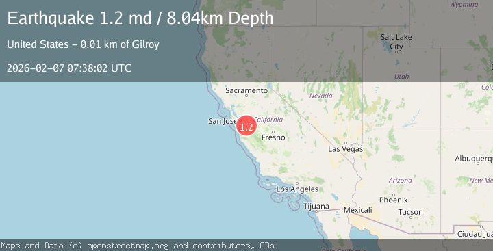
A 1.2 magnitude earthquake struck on 10 km NE of Gilroy, CA, at Sat, 07 Feb 2026 07:38:02 GMT. Depth: 8.03999996185303km. Reviewed by USGS seismologists, this minor quake occurred at a magnitude type of md.
Magnitude
1.2
md
Source
USGS
Intensity
-
Agency Reports
1 Sources| Source | Magnitude | Depth | Time |
|---|---|---|---|
| USGSPrimary | 1.2 | 8 km | 1 hour ago |
Earthquake Details
AutomaticEvent IDusgs_nc75309982
Tsunami PotentialNo
Magnitude Typemd
Nearest Places
- Bear Creek0.1 km
- Department of Forestry and Fire Protection Station 21 Coyote0.8 km
- Cañada De Los Osos0.8 km
- Dexter Canyon1.0 km
- Pigeon Point2.1 km
Comments
Join the discussion about this event.
Latest Earthquakes
2.1Mag
20 km W of Anchor Point, Alaska
Time12 minutes ago
Depth66.90 km
SourceUSGS (Automatic)
2.4Mag
Northern Sumatra, Indonesia
Time13 minutes ago
Depth10.00 km
SourceBMKG (Automatic)
3.6Mag
OFF E. COAST OF N. ISLAND, N.Z.
Time15 minutes ago
Depth260.00 km
SourceGNS (Automatic)
1.3Mag
62 km ESE of Knik River, Alaska
Time19 minutes ago
Depth38.00 km
SourceUSGS (Automatic)
3.4Mag
Sumba Region, Indonesia
Time22 minutes ago
Depth19.73 km
SourceBMKG (Automatic)
Nearby Earthquakes
1.4Mag
9 km ENE of Gilroy, CA
Time5 days ago
Depth10.64 km
SourceUSGS (Automatic)
1.9Mag
9 km ENE of Gilroy, CA
Time1 week ago
Depth8.54 km
SourceUSGS (Automatic)
1.4Mag
18 km NNE of Hollister, CA
Time1 week ago
Depth10.28 km
SourceUSGS (Automatic)
2.8Mag
6 km SSW of Gilroy, CA
Time5 days ago
Depth7.92 km
SourceUSGS (Automatic)
1.3Mag
6 km WSW of Gilroy, CA
Time1 week ago
Depth4.77 km
SourceUSGS (Automatic)