Earthquake 19 km W of Petrolia, CA
Tue, 03 Mar 2026 23:02:57 GMT
Time1 hour ago
Location
40.3252, -124.5148
Depth
22.4 KM
Event Summary
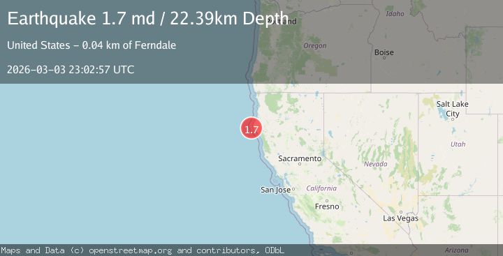
A 1.7 magnitude earthquake struck on 19 km W of Petrolia, CA, at Tue, 03 Mar 2026 23:02:57 GMT. Depth: 22.3899993896484km. Reviewed by USGS seismologists, this minor quake occurred at a magnitude type of md.
Magnitude
1.7
md
Source
USGS
Intensity
-
Agency Reports
1 Sources| Source | Magnitude | Depth | Time |
|---|---|---|---|
| USGSPrimary | 1.7 | 22 km | 1 hour ago |
Earthquake Details
AutomaticEvent IDusgs_nc75322157
Tsunami PotentialNo
Magnitude Typemd
Nearest Places
- 7.2 km
- 7.2 km
- 9.0 km
- 12.1 km
- 12.7 km
Comments
Join the discussion about this event.
Latest Earthquakes
2.5Mag
Sumbawa Region, Indonesia
Time1 hour ago
Depth25.13 km
SourceBMKG
0.6Mag
9 km NE of Julian, CA
Time1 hour ago
Depth6.03 km
SourceUSGS (Automatic)
3.1Mag
Sulawesi, Indonesia
Time1 hour ago
Depth1.59 km
SourceVYT (Automatic)
2.4Mag
offshore Bio-Bio, Chile
Time1 hour ago
Depth0.12 km
SourceVYT (Automatic)
1.5Mag
NEAR THE COAST OF WESTERN TURKEY
Time1 hour ago
Depth11.20 km
SourceAFAD (Automatic)
Nearby Earthquakes
6.2Mag
OFFSHORE NORTHERN CALIFORNIA
Time4 years ago
Depth26.00 km
SourceEMSC (Automatic)
2.2Mag
OFFSHORE NORTHERN CALIFORNIA
Time2 weeks ago
Depth12.20 km
SourceNC (Automatic)
2.3Mag
22 km W of Petrolia, CA
Time1 month ago
Depth11.53 km
SourceUSGS (Automatic)
3.0Mag
OFFSHORE NORTHERN CALIFORNIA
Time12 years ago
Depth7.00 km
SourceNC (Automatic)
3.0Mag
OFFSHORE NORTHERN CALIFORNIA
Time11 years ago
Depth19.00 km
SourceNC (Automatic)