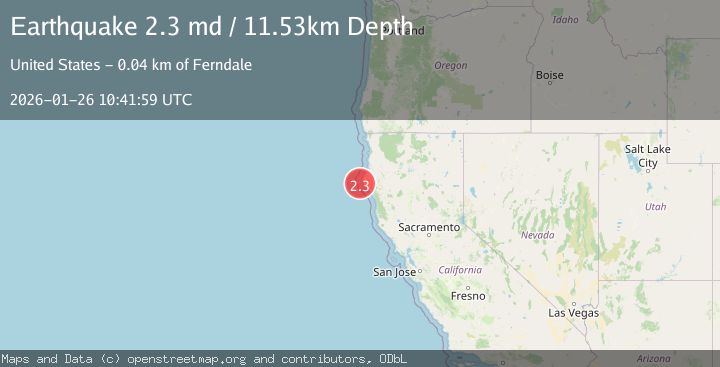
Earthquake 22 km W of Petrolia, CA
Mon, 26 Jan 2026 10:41:59 GMT
Time1 day ago
Location
40.3183, -124.5395
Depth
11.5 KM
Event Summary
A 2.3 magnitude earthquake struck on 22 km W of Petrolia, CA, at Mon, 26 Jan 2026 10:41:59 GMT. Depth: 11.5299997329712km. Reviewed by USGS seismologists, this minor quake occurred at a magnitude type of md.
Magnitude
2.3
md
Source
USGS
Intensity
-
Agency Reports
1 Sources| Source | Magnitude | Depth | Time |
|---|---|---|---|
| USGSPrimary | 2.3 | 12 km | 1 day ago |
Earthquake Details
AutomaticEvent IDusgs_nc75301891
Tsunami PotentialNo
Magnitude Typemd
Nearest Places
- Mendocino Canyon7.8 km
- Mattole Canyon8.5 km
- Mendocino Canyon9.3 km
- Blunts Reef Coast Guard Station13.2 km
- The Great Break14.4 km
Comments
Join the discussion about this event.
Latest Earthquakes
2.4Mag
NEVADA
Time7 minutes ago
Depth16.00 km
SourceNN (Automatic)
3.1Mag
Northern Molucca Sea
Time8 minutes ago
Depth31.63 km
SourceBMKG (Automatic)
2.1Mag
SOUTHERN ITALY
Time13 minutes ago
Depth10.00 km
SourceINGV (Automatic)
2.6Mag
Northern Sumatra, Indonesia
Time13 minutes ago
Depth0.60 km
SourceBMKG (Automatic)
2.1Mag
SOUTHERN TEXAS
Time13 minutes ago
Depth0.00 km
SourceTX (Automatic)
Nearby Earthquakes
1.9Mag
18 km W of Petrolia, CA
Time16 hours ago
Depth18.85 km
SourceUSGS (Automatic)
1.6Mag
13 km NE of Hydesville, CA
Time1 day ago
Depth12.10 km
SourceUSGS (Automatic)
2.7Mag
OFFSHORE NORTHERN CALIFORNIA
Time4 days ago
Depth0.20 km
SourceNC (Automatic)
2.9Mag
86 km W of Petrolia, CA
Time18 hours ago
Depth20.24 km
SourceUSGS (Automatic)
2.2Mag
NORTHERN CALIFORNIA
Time5 days ago
Depth27.70 km
SourceNC (Automatic)