Earthquake 12 km WNW of The Geysers, CA
Wed, 04 Mar 2026 17:36:59 GMT
Time2 hours ago
Location
38.8335, -122.8785
Depth
18.5 KM
Event Summary
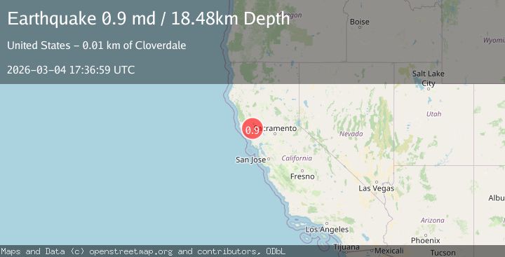
A 0.9 magnitude earthquake struck on 12 km WNW of The Geysers, CA, at Wed, 04 Mar 2026 17:36:59 GMT. Depth: 18.4799995422363km. Reviewed by USGS seismologists, this minor quake occurred at a magnitude type of md.
Magnitude
0.9
md
Source
USGS
Intensity
-
Agency Reports
1 Sources| Source | Magnitude | Depth | Time |
|---|---|---|---|
| USGSPrimary | 0.9 | 18 km | 2 hours ago |
Earthquake Details
AutomaticEvent IDusgs_nc75322452
Tsunami PotentialNo
Magnitude Typemd
Nearest Places
- 0.9 km
- 1.0 km
- 1.2 km
- 1.4 km
- 1.8 km
Comments
Join the discussion about this event.
Latest Earthquakes
2.9Mag
Maine
Time1 hour ago
Depth256.47 km
SourceVYT (Automatic)
1.5Mag
12 km NE of Tecopa, California
Time1 hour ago
Depth0.04 km
SourceUSGS (Automatic)
2.0Mag
Southern California
Time1 hour ago
Depth0.00 km
SourceVYT (Automatic)
2.3Mag
Southern Alaska
Time1 hour ago
Depth20.02 km
SourceVYT (Automatic)
5.4Mag
OFFSHORE EL SALVADOR
Time1 hour ago
Depth73.60 km
SourceGFZ (Automatic)
Nearby Earthquakes
0.8Mag
12 km WNW of The Geysers, CA
Time2 weeks ago
Depth2.90 km
SourceUSGS (Automatic)
0.8Mag
12 km ENE of Cloverdale, CA
Time1 month ago
Depth1.97 km
SourceUSGS (Automatic)
1.1Mag
13 km ENE of Cloverdale, CA
Time2 weeks ago
Depth2.05 km
SourceUSGS (Automatic)
0.3Mag
13 km NW of The Geysers, CA
Time3 days ago
Depth2.65 km
SourceUSGS (Automatic)
1.2Mag
13 km NW of The Geysers, CA
Time3 weeks ago
Depth2.43 km
SourceUSGS (Automatic)