Earthquake 12 km SSW of Walker, California
Thu, 01 Jan 2026 05:26:48 GMT
Time1 hour ago
Location
38.4182, -119.5550
Depth
9.1 KM
Event Summary
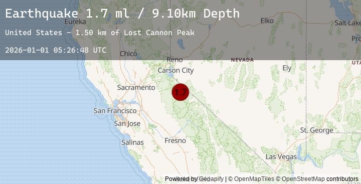
A 1.7 magnitude earthquake struck on 12 km SSW of Walker, California, at Thu, 01 Jan 2026 05:26:48 GMT. Depth: 9.1008km. Reviewed by USGS seismologists, this minor quake occurred at a magnitude type of ml.
Magnitude
1.7
ml
Source
USGS
Intensity
-
Earthquake Details
AutomaticEvent IDusgs_nn00909109
Tsunami PotentialNo
Magnitude Typeml
Nearest Places
- Lost Cannon Peak1.5 km
- Fish Valley Peak2.3 km
- Early Emigrant and Indian Trail2.6 km
- Summit Meadow2.8 km
- Wells Peak3.5 km
Comments
Join the discussion about this event.
Latest Earthquakes
0.7Mag
6 km W of Cobb, CA
Time8 minutes ago
Depth1.83 km
SourceUSGS (Automatic)
1.9Mag
11 km WNW of Bridgeport, California
Time9 minutes ago
Depth3.61 km
SourceUSGS (Automatic)
1.8Mag
17 km NE of Tres Pinos, CA
Time11 minutes ago
Depth36.94 km
SourceUSGS (Automatic)
3.2Mag
SOUTHERN YUKON TERRITORY, CANADA
Time12 minutes ago
Depth5.90 km
SourceEMSC (Automatic)
3.2Mag
111 km NNW of Yakutat, Alaska
Time12 minutes ago
Depth5.95 km
SourceUSGS