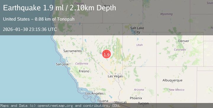
Earthquake 82 km NE of Tonopah, Nevada
Fri, 30 Jan 2026 23:15:36 GMT
Time7 hours ago
Location
38.4909, -116.4524
Depth
2.1 KM
Event Summary
A 1.9 magnitude earthquake struck on 82 km NE of Tonopah, Nevada, at Fri, 30 Jan 2026 23:15:36 GMT. Depth: 2.0974km. Reviewed by USGS seismologists, this minor quake occurred at a magnitude type of ml.
Magnitude
1.9
ml
Source
USGS
Intensity
-
Agency Reports
1 Sources| Source | Magnitude | Depth | Time |
|---|---|---|---|
| USGSPrimary | 1.9 | 2 km | 7 hours ago |
Earthquake Details
AutomaticEvent IDusgs_nn00910191
Tsunami PotentialNo
Magnitude Typeml
Nearest Places
- Mountain View Mill (historical)4.1 km
- Mountain View4.1 km
- Arrastra Ruins4.6 km
- Page Springs4.7 km
- Upper Warm Spring4.7 km
Comments
Join the discussion about this event.
Latest Earthquakes
4.0Mag
Borneo
Time15 minutes ago
Depth15.30 km
SourceBMKG (Automatic)
2.5Mag
NICARAGUA
Time34 minutes ago
Depth3.00 km
SourceINET (Automatic)
1.3Mag
17 km ESE of Anza, CA
Time41 minutes ago
Depth11.69 km
SourceUSGS (Automatic)
3.0Mag
CENTRAL ALASKA
Time42 minutes ago
Depth88.60 km
SourceAK (Automatic)
5.0Mag
SOUTH SANDWICH ISLANDS REGION
Time44 minutes ago
Depth39.00 km
SourceEMSC (Automatic)
Nearby Earthquakes
1.5Mag
18 km E of Goldfield, Nevada
Time4 days ago
Depth3.68 km
SourceUSGS (Automatic)
1.6Mag
10 km ENE of Goldfield, Nevada
Time2 hours ago
Depth1.44 km
SourceUSGS (Automatic)
2.2Mag
NEVADA
Time4 days ago
Depth10.60 km
SourceNN (Automatic)
2.3Mag
NEVADA
Time4 days ago
Depth9.80 km
SourceNN (Automatic)
2.2Mag
NEVADA
Time5 days ago
Depth7.50 km
SourceNN (Automatic)