Earthquake 15 km WNW of Silver Peak, Nevada
Fri, 06 Feb 2026 19:19:49 GMT
Time1 hour ago
Location
37.8225, -117.7923
Depth
9.1 KM
Event Summary
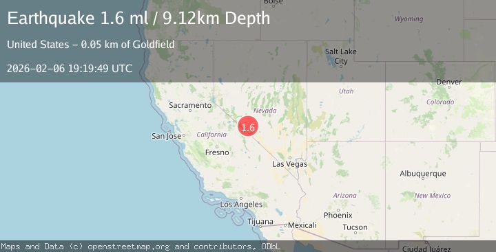
A 1.6 magnitude earthquake struck on 15 km WNW of Silver Peak, Nevada, at Fri, 06 Feb 2026 19:19:49 GMT. Depth: 9.1246km. Reviewed by USGS seismologists, this minor quake occurred at a magnitude type of ml.
Magnitude
1.6
ml
Source
USGS
Intensity
-
Agency Reports
1 Sources| Source | Magnitude | Depth | Time |
|---|---|---|---|
| USGSPrimary | 1.6 | 9 km | 1 hour ago |
Earthquake Details
AutomaticEvent IDusgs_nn00910463
Tsunami PotentialNo
Magnitude Typeml
Nearest Places
- North Spring0.5 km
- Rhyolite Ridge1.8 km
- North Star Mine2.9 km
- Coyote Hole3.0 km
- Coyote Hole3.0 km
Comments
Join the discussion about this event.
Latest Earthquakes
1.6Mag
40 km NNW of Glacier View, Alaska
Time17 minutes ago
Depth34.70 km
SourceUSGS (Automatic)
1.6Mag
47 km NW of Toyah, Texas
Time27 minutes ago
Depth4.26 km
SourceUSGS (Automatic)
1.5Mag
8 km NW of The Geysers, CA
Time31 minutes ago
Depth2.05 km
SourceUSGS (Automatic)
1.4Mag
WESTERN TURKEY
Time33 minutes ago
Depth6.20 km
SourceEMSC (Automatic)
2.0Mag
Northern Sumatra, Indonesia
Time34 minutes ago
Depth5.01 km
SourceBMKG (Automatic)
Nearby Earthquakes
2.2Mag
NEVADA
Time1 week ago
Depth7.50 km
SourceNN (Automatic)
2.2Mag
NEVADA
Time1 week ago
Depth10.60 km
SourceNN (Automatic)
1.6Mag
38 km ESE of Mina, Nevada
Time1 day ago
Depth3.72 km
SourceUSGS (Automatic)
3.4Mag
NEVADA
Time1 week ago
Depth13.30 km
SourceNN (Automatic)
1.7Mag
35 km SSE of Dyer, Nevada
Time6 days ago
Depth2.19 km
SourceUSGS (Automatic)