Earthquake 57 km NE of Tonopah, Nevada
Sat, 28 Feb 2026 16:33:38 GMT
Time1 hour ago
Location
38.3666, -116.6915
Depth
0.0 KM
Event Summary
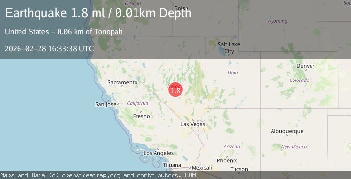
A 1.8 magnitude earthquake struck on 57 km NE of Tonopah, Nevada, at Sat, 28 Feb 2026 16:33:38 GMT. Depth: 0.0094km. Reviewed by USGS seismologists, this minor quake occurred at a magnitude type of ml.
Magnitude
1.8
ml
Source
USGS
Intensity
-
Agency Reports
1 Sources| Source | Magnitude | Depth | Time |
|---|---|---|---|
| USGSPrimary | 1.8 | 0 km | 1 hour ago |
Earthquake Details
AutomaticEvent IDusgs_nn00911369
Tsunami PotentialNo
Magnitude Typeml
Nearest Places
- 2.1 km
- 2.3 km
- 2.7 km
- 4.0 km
- 4.5 km
Comments
Join the discussion about this event.
Latest Earthquakes
1.5Mag
Southeastern Alaska
Time1 hour ago
Depth21.12 km
SourceVYT (Automatic)
2.3Mag
Tarapaca, Chile
Time1 hour ago
Depth33.45 km
SourceVYT (Automatic)
2.1Mag
offshore Coquimbo, Chile
Time1 hour ago
Depth90.33 km
SourceVYT (Automatic)
1.6Mag
79 km NE of Tonopah, Nevada
Time1 hour ago
Depth8.39 km
SourceUSGS (Automatic)
1.6Mag
Kenai Peninsula, Alaska
Time1 hour ago
Depth0.61 km
SourceVYT (Automatic)
Nearby Earthquakes
1.5Mag
53 km NE of Tonopah, Nevada
Time11 hours ago
Depth10.29 km
SourceUSGS (Automatic)
1.7Mag
63 km NE of Tonopah, Nevada
Time9 hours ago
Depth12.21 km
SourceUSGS (Automatic)
1.7Mag
51 km NE of Tonopah, Nevada
Time2 hours ago
Depth4.97 km
SourceUSGS (Automatic)
1.8Mag
51 km NE of Tonopah, Nevada
Time10 hours ago
Depth4.41 km
SourceUSGS (Automatic)
1.7Mag
50 km NE of Tonopah, Nevada
Time9 hours ago
Depth3.82 km
SourceUSGS (Automatic)