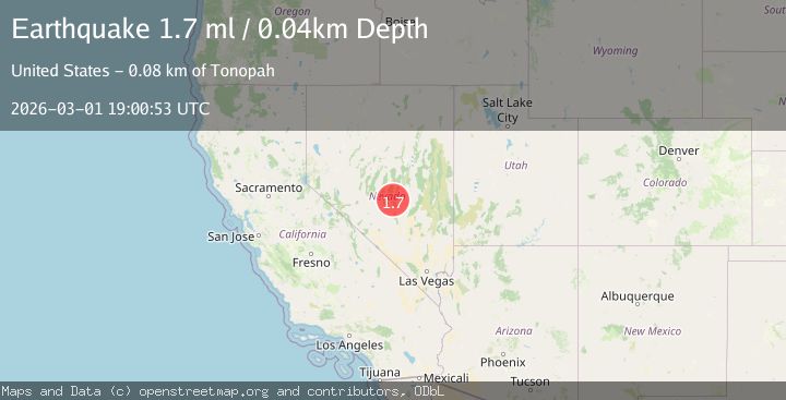
Earthquake 79 km NE of Tonopah, Nevada
Sun, 01 Mar 2026 19:00:53 GMT
Time1 hour ago
Location
38.4744, -116.4772
Depth
0.0 KM
Event Summary
A 1.7 magnitude earthquake struck on 79 km NE of Tonopah, Nevada, at Sun, 01 Mar 2026 19:00:53 GMT. Depth: 0.0366km. Reviewed by USGS seismologists, this minor quake occurred at a magnitude type of ml.
Magnitude
1.7
ml
Source
USGS
Intensity
-
Agency Reports
1 Sources| Source | Magnitude | Depth | Time |
|---|---|---|---|
| USGSPrimary | 1.7 | 0 km | 1 hour ago |
Earthquake Details
AutomaticEvent IDusgs_nn00911524
Tsunami PotentialNo
Magnitude Typeml
Nearest Places
- 3.6 km
- 4.3 km
- 5.6 km
- 6.0 km
- 6.3 km
Comments
Join the discussion about this event.
Latest Earthquakes
3.1Mag
OFF E. COAST OF S. ISLAND, N.Z.
Time37 minutes ago
Depth646.40 km
SourceGNS (Automatic)
1.6Mag
75 km NE of Tonopah, Nevada
Time42 minutes ago
Depth16.00 km
SourceUSGS (Automatic)
2.7Mag
Sumbawa Region, Indonesia
Time46 minutes ago
Depth290.29 km
SourceBMKG
3.1Mag
GUATEMALA
Time46 minutes ago
Depth2.00 km
SourceINET (Automatic)
5.0Mag
NEAR EAST COAST OF KAMCHATKA
Time47 minutes ago
Depth66.00 km
SourceEMSC (Automatic)
Nearby Earthquakes
1.8Mag
79 km NE of Tonopah, Nevada
Time3 hours ago
Depth0.64 km
SourceUSGS (Automatic)
2.2Mag
80 km NE of Tonopah, Nevada
Time17 hours ago
Depth4.77 km
SourceUSGS (Automatic)
1.7Mag
79 km NE of Tonopah, Nevada
Time12 hours ago
Depth7.14 km
SourceUSGS (Automatic)
1.6Mag
80 km NE of Tonopah, Nevada
Time13 hours ago
Depth1.64 km
SourceUSGS (Automatic)
1.8Mag
79 km NE of Tonopah, Nevada
Time2 hours ago
Depth8.12 km
SourceUSGS (Automatic)