Earthquake 8 km ENE of Calumet, Oklahoma
Fri, 20 Feb 2026 01:45:13 GMT
Time1 hour ago
Location
35.6248, -98.0272
Depth
6.0 KM
Event Summary
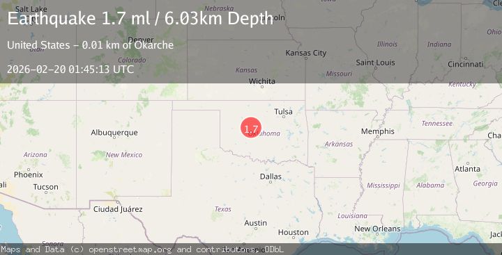
A 1.7 magnitude earthquake struck on 8 km ENE of Calumet, Oklahoma, at Fri, 20 Feb 2026 01:45:13 GMT. Depth: 6.028060913km. Reviewed by USGS seismologists, this minor quake occurred at a magnitude type of ml.
Magnitude
1.7
ml
Source
USGS
Intensity
-
Agency Reports
1 Sources| Source | Magnitude | Depth | Time |
|---|---|---|---|
| USGSPrimary | 1.7 | 6 km | 1 hour ago |
Earthquake Details
AutomaticEvent IDusgs_ok2026dnmq
Tsunami PotentialNo
Magnitude Typeml
Nearest Places
- Olivet Church0.6 km
- Concho3.1 km
- Concho School3.6 km
- Township of Darlington3.8 km
- Concho Cemetery3.9 km
Comments
Join the discussion about this event.
Latest Earthquakes
3.9Mag
Mediterranean Region, Turkey
Time2 minutes ago
Depth71.53 km
SourceVYT (Automatic)
2.9Mag
Antofagasta, Chile
Time5 minutes ago
Depth267.46 km
SourceVYT (Automatic)
1.3Mag
10 km NW of Pine Valley, CA
Time5 minutes ago
Depth8.85 km
SourceUSGS (Automatic)
2.3Mag
Alaska Peninsula
Time13 minutes ago
Depth0.00 km
SourceVYT (Automatic)
5.0Mag
Halmahera, Indonesia
Time14 minutes ago
Depth105.96 km
SourceVYT (Automatic)
Nearby Earthquakes
2.2Mag
OKLAHOMA
Time1 week ago
Depth3.60 km
SourceOK (Automatic)
3.6Mag
OKLAHOMA
Time3 days ago
Depth1.90 km
SourceOK (Automatic)
2.8Mag
OKLAHOMA
Time1 week ago
Depth2.10 km
SourceOK (Automatic)
1.9Mag
8 km ENE of Calumet, Oklahoma
Time1 week ago
Depth3.46 km
SourceUSGS (Automatic)
3.4Mag
OKLAHOMA
Time14 hours ago
Depth0.40 km
SourceOK (Automatic)