Earthquake 96 km NE of Punta Cana, Dominican Republic
Mon, 02 Feb 2026 09:19:25 GMT
Time4 days ago
Location
19.2297, -67.7888
Depth
39.3 KM
Event Summary
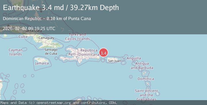
A 3.4 magnitude earthquake struck on 96 km NE of Punta Cana, Dominican Republic, at Mon, 02 Feb 2026 09:19:25 GMT. Depth: 39.27km. Reviewed by USGS seismologists, this minor quake occurred at a magnitude type of md.
Magnitude
3.4
md
Source
USGS
Intensity
-
Agency Reports
1 Sources| Source | Magnitude | Depth | Time |
|---|---|---|---|
| USGSPrimary | 3.4 | 39 km | 4 days ago |
Earthquake Details
ConfirmedEvent IDusgs_pr71506343
Tsunami PotentialNo
Magnitude Typemd
Nearest Places
- Mona Seamount24.3 km
- Engaño Canyon38.5 km
- Maimón Escarpment43.2 km
- Maimón Basin47.0 km
- Mona Canyon49.7 km
Comments
Join the discussion about this event.
Latest Earthquakes
0.9Mag
16 km NE of Little Lake, CA
Time6 minutes ago
Depth3.73 km
SourceUSGS (Automatic)
2.3Mag
Sumba Region, Indonesia
Time12 minutes ago
Depth49.56 km
SourceBMKG (Automatic)
2.8Mag
Southwest of Sumatra, Indonesia
Time16 minutes ago
Depth10.00 km
SourceBMKG (Automatic)
2.0Mag
ISLAND OF HAWAII, HAWAII
Time22 minutes ago
Depth2.50 km
SourceHV (Automatic)
2.6Mag
Java, Indonesia
Time28 minutes ago
Depth9.73 km
SourceBMKG (Automatic)
Nearby Earthquakes
3.3Mag
88 km NNE of Punta Cana, Dominican Republic
Time1 week ago
Depth51.99 km
SourceUSGS
2.8Mag
PUERTO RICO REGION
Time1 week ago
Depth10.00 km
SourceNEIC (Automatic)
3.1Mag
53 km NW of San Antonio, Puerto Rico
Time1 day ago
Depth9.13 km
SourceUSGS
2.6Mag
47 km NW of San Antonio, Puerto Rico
Time2 hours ago
Depth21.25 km
SourceUSGS
3.1Mag
PUERTO RICO REGION
Time5 days ago
Depth21.20 km
SourcePR (Automatic)