Earthquake 24 km W of Mentone, Texas
Tue, 27 Jan 2026 17:40:13 GMT
Time3 hours ago
Location
31.7060, -103.8610
Depth
0.0 KM
Event Summary
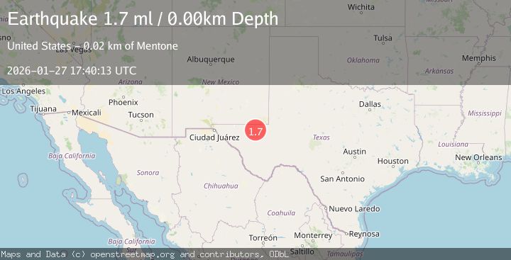
A 1.7 magnitude earthquake struck on 24 km W of Mentone, Texas, at Tue, 27 Jan 2026 17:40:13 GMT. Depth: 0km. Reviewed by USGS seismologists, this minor quake occurred at a magnitude type of ml.
Magnitude
1.7
ml
Source
USGS
Intensity
-
Agency Reports
1 Sources| Source | Magnitude | Depth | Time |
|---|---|---|---|
| USGSPrimary | 1.7 | 0 km | 3 hours ago |
Earthquake Details
AutomaticEvent IDusgs_tx2026bxbzvv
Tsunami PotentialNo
Magnitude Typeml
Nearest Places
- Allarmarks Oil Field1.8 km
- Regan Oil Field2.3 km
- Threemile Draw2.7 km
- Hackberry Windmill3.7 km
- Hackberry Tank4.6 km
Comments
Join the discussion about this event.
Latest Earthquakes
2.0Mag
52 km SSE of Denali National Park, Alaska
Time7 minutes ago
Depth5.00 km
SourceUSGS (Automatic)
1.6Mag
11 km W of Pine Valley, CA
Time9 minutes ago
Depth16.83 km
SourceUSGS (Automatic)
3.5Mag
CRETE, GREECE
Time15 minutes ago
Depth10.00 km
SourceTHE (Automatic)
2.3Mag
6 km ESE of Elgin, South Carolina
Time21 minutes ago
Depth5.00 km
SourceUSGS
1.6Mag
86 km NNW of Karluk, Alaska
Time28 minutes ago
Depth5.00 km
SourceUSGS (Automatic)
Nearby Earthquakes
2.1Mag
36 km NNW of Toyah, Texas
Time1 day ago
Depth4.41 km
SourceUSGS (Automatic)
1.5Mag
24 km NNW of Toyah, Texas
Time3 days ago
Depth3.52 km
SourceUSGS (Automatic)
2.0Mag
WESTERN TEXAS
Time6 days ago
Depth4.30 km
SourceTX (Automatic)
1.5Mag
37 km NW of Toyah, Texas
Time5 days ago
Depth6.63 km
SourceUSGS (Automatic)
1.5Mag
36 km NW of Toyah, Texas
Time2 days ago
Depth5.77 km
SourceUSGS (Automatic)