Earthquake 2 km E of North Pearsall, Texas
Tue, 27 Jan 2026 22:01:47 GMT
Time1 hour ago
Location
28.9180, -99.0710
Depth
3.0 KM
Event Summary
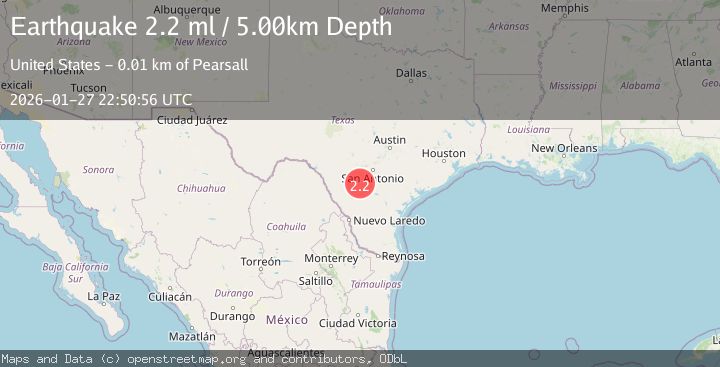
A 2.2 magnitude earthquake struck on 2 km E of North Pearsall, Texas, at Tue, 27 Jan 2026 22:01:47 GMT. Depth: 2.9783km. Reviewed by USGS seismologists, this minor quake occurred at a magnitude type of ml.
Magnitude
2.2
ml
Source
USGS
Intensity
-
Agency Reports
2 Sources| Source | Magnitude | Depth | Time |
|---|---|---|---|
| USGSPrimary | 2.2 | 5 km | 1 hour ago |
| TX | 2.2 | 5 km | 1 hour ago |
Earthquake Details
AutomaticEvent IDusgs_tx2026bxkrxf
Tsunami PotentialNo
Magnitude Typeml
Nearest Places
- Morrow Dam Number 31.6 km
- Agricultural Supplies Airport1.6 km
- Morrow Lake Number 31.7 km
- Pearsall High School2.5 km
- North Pearsall2.5 km
Comments
Join the discussion about this event.
Latest Earthquakes
2.1Mag
West Papua Region, Indonesia
Time7 minutes ago
Depth10.00 km
SourceBMKG (Automatic)
3.9Mag
SAN JUAN, ARGENTINA
Time8 minutes ago
Depth138.70 km
SourceCSN (Automatic)
4.0Mag
BANDA SEA
Time9 minutes ago
Depth101.00 km
SourceBMKG (Automatic)
1.6Mag
1 km WSW of Pittsburg, CA
Time11 minutes ago
Depth15.89 km
SourceUSGS (Automatic)
3.5Mag
TARAPACA, CHILE
Time16 minutes ago
Depth54.30 km
SourceCSN (Automatic)
Nearby Earthquakes
2.0Mag
3 km ENE of Pearsall, Texas
Time16 hours ago
Depth8.07 km
SourceUSGS (Automatic)
1.9Mag
2 km E of Pearsall, Texas
Time1 day ago
Depth6.03 km
SourceUSGS (Automatic)
2.0Mag
SOUTHERN TEXAS
Time5 days ago
Depth6.10 km
SourceTX (Automatic)
2.0Mag
6 km ENE of North Pearsall, Texas
Time5 days ago
Depth6.08 km
SourceUSGS (Automatic)
2.1Mag
SOUTHERN TEXAS
Time1 day ago
Depth6.70 km
SourceTX (Automatic)