Earthquake 16 km NNW of Toyah, Texas
Thu, 29 Jan 2026 01:09:09 GMT
Time1 hour ago
Location
31.4460, -103.8650
Depth
6.7 KM
Event Summary
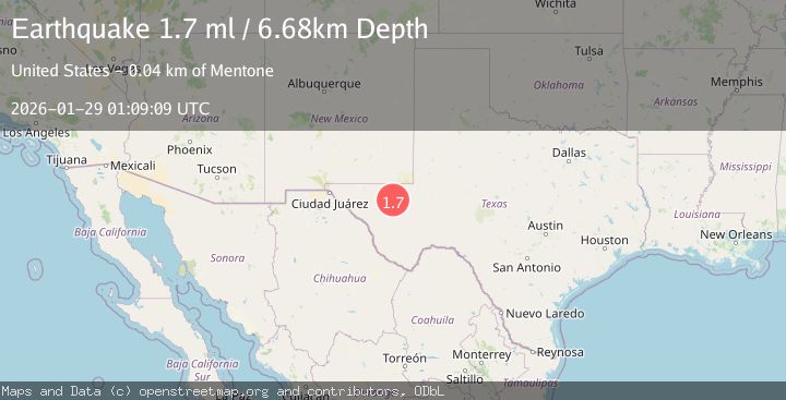
A 1.7 magnitude earthquake struck on 16 km NNW of Toyah, Texas, at Thu, 29 Jan 2026 01:09:09 GMT. Depth: 6.6751km. Reviewed by USGS seismologists, this minor quake occurred at a magnitude type of ml.
Magnitude
1.7
ml
Source
USGS
Intensity
-
Agency Reports
1 Sources| Source | Magnitude | Depth | Time |
|---|---|---|---|
| USGSPrimary | 1.7 | 7 km | 1 hour ago |
Earthquake Details
AutomaticEvent IDusgs_tx2026bzmpzr
Tsunami PotentialNo
Magnitude Typeml
Nearest Places
- R E Windmill1.3 km
- Seep Well2.5 km
- New Windmill2.9 km
- Rock Tank3.5 km
- Mare Tank3.8 km
Comments
Join the discussion about this event.
Latest Earthquakes
3.1Mag
Southern Sumatra, Indonesia
Time5 minutes ago
Depth78.72 km
SourceBMKG (Automatic)
2.5Mag
WESTERN TEXAS
Time11 minutes ago
Depth3.80 km
SourceTX (Automatic)
3.7Mag
GUATEMALA
Time14 minutes ago
Depth93.00 km
SourceINET (Automatic)
3.4Mag
SAN JUAN, ARGENTINA
Time16 minutes ago
Depth10.00 km
SourceNSNA (Automatic)
4.4Mag
NEAR EAST COAST OF HONSHU, JAPAN
Time19 minutes ago
Depth30.00 km
SourceJMA (Automatic)
Nearby Earthquakes
1.5Mag
24 km NNW of Toyah, Texas
Time5 days ago
Depth3.52 km
SourceUSGS (Automatic)
1.8Mag
31 km NW of Toyah, Texas
Time6 days ago
Depth3.43 km
SourceUSGS (Automatic)
1.5Mag
31 km NW of Toyah, Texas
Time5 days ago
Depth4.49 km
SourceUSGS (Automatic)
1.7Mag
34 km NW of Toyah, Texas
Time3 days ago
Depth4.59 km
SourceUSGS (Automatic)
2.0Mag
WESTERN TEXAS
Time1 week ago
Depth4.30 km
SourceTX (Automatic)