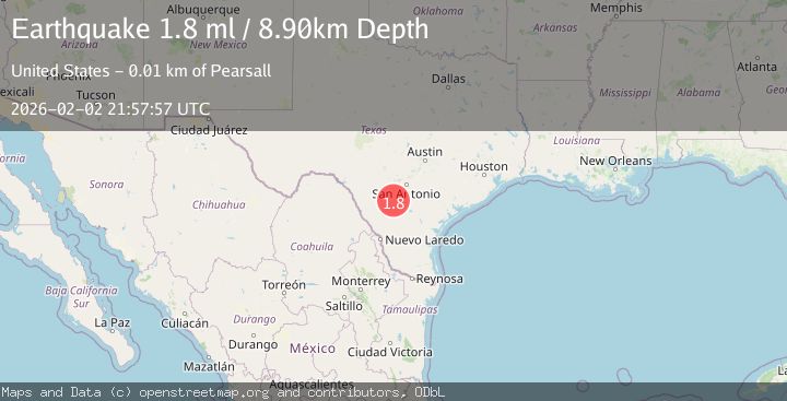
Earthquake 10 km ESE of Pearsall, Texas
Mon, 02 Feb 2026 21:57:57 GMT
Time1 hour ago
Location
28.8530, -98.9970
Depth
8.9 KM
Event Summary
A 1.8 magnitude earthquake struck on 10 km ESE of Pearsall, Texas, at Mon, 02 Feb 2026 21:57:57 GMT. Depth: 8.8968km. Reviewed by USGS seismologists, this minor quake occurred at a magnitude type of ml.
Magnitude
1.8
ml
Source
USGS
Intensity
-
Agency Reports
1 Sources| Source | Magnitude | Depth | Time |
|---|---|---|---|
| USGSPrimary | 1.8 | 9 km | 1 hour ago |
Earthquake Details
AutomaticEvent IDusgs_tx2026cikxxa
Tsunami PotentialNo
Magnitude Typeml
Nearest Places
- Morrow Lake Number 1 Dam4.6 km
- Morrow Lake Number 14.8 km
- Buckhorn Cemetery5.7 km
- Jay Kay Ranch Airport5.8 km
- Morrow Lake Number 25.8 km
Comments
Join the discussion about this event.
Latest Earthquakes
1.5Mag
19 km NNE of Indio, CA
Time3 minutes ago
Depth3.99 km
SourceUSGS (Automatic)
2.3Mag
Sumbawa Region, Indonesia
Time9 minutes ago
Depth13.16 km
SourceBMKG (Automatic)
2.2Mag
7 km S of Badger, Alaska
Time22 minutes ago
Depth19.20 km
SourceUSGS (Automatic)
1.9Mag
87 km N of Yakutat, Alaska
Time34 minutes ago
Depth5.00 km
SourceUSGS (Automatic)
1.8Mag
44 km NW of Tatitlek, Alaska
Time38 minutes ago
Depth17.80 km
SourceUSGS (Automatic)
Nearby Earthquakes
1.9Mag
11 km E of Pearsall, Texas
Time5 days ago
Depth13.00 km
SourceUSGS (Automatic)
2.2Mag
SOUTHERN TEXAS
Time1 week ago
Depth9.50 km
SourceTX (Automatic)
2.4Mag
SOUTHERN TEXAS
Time2 days ago
Depth6.00 km
SourceTX (Automatic)
2.4Mag
7 km ESE of Pearsall, Texas
Time2 days ago
Depth5.98 km
SourceUSGS (Automatic)
1.8Mag
10 km E of Pearsall, Texas
Time5 days ago
Depth9.52 km
SourceUSGS (Automatic)