Earthquake 10 km ESE of Pearsall, Texas
Wed, 04 Feb 2026 12:18:11 GMT
Time1 hour ago
Location
28.8680, -98.9920
Depth
9.8 KM
Event Summary
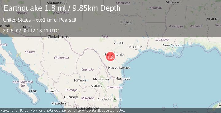
A 1.8 magnitude earthquake struck on 10 km ESE of Pearsall, Texas, at Wed, 04 Feb 2026 12:18:11 GMT. Depth: 9.8456km. Reviewed by USGS seismologists, this minor quake occurred at a magnitude type of ml.
Magnitude
1.8
ml
Source
USGS
Intensity
-
Agency Reports
1 Sources| Source | Magnitude | Depth | Time |
|---|---|---|---|
| USGSPrimary | 1.8 | 10 km | 1 hour ago |
Earthquake Details
AutomaticEvent IDusgs_tx2026cljebd
Tsunami PotentialNo
Magnitude Typeml
Nearest Places
- Morrow Lake Number 1 Dam3.4 km
- Morrow Lake Number 13.6 km
- Morrow Lake Number 24.5 km
- Morrow Lake Number 2 Dam4.6 km
- Rancho Pobre5.0 km
Comments
Join the discussion about this event.
Latest Earthquakes
2.2Mag
12 km NNE of Cantwell, Alaska
Time3 minutes ago
Depth0.00 km
SourceUSGS (Automatic)
2.8Mag
Flores Region, Indonesia
Time6 minutes ago
Depth96.66 km
SourceBMKG (Automatic)
2.1Mag
Sulawesi, Indonesia
Time8 minutes ago
Depth10.03 km
SourceBMKG (Automatic)
2.1Mag
Java, Indonesia
Time12 minutes ago
Depth119.72 km
SourceBMKG (Automatic)
2.0Mag
18 km WSW of Johannesburg, CA
Time28 minutes ago
Depth4.58 km
SourceUSGS (Automatic)
Nearby Earthquakes
1.9Mag
11 km E of Pearsall, Texas
Time1 week ago
Depth13.00 km
SourceUSGS (Automatic)
2.2Mag
SOUTHERN TEXAS
Time1 week ago
Depth9.50 km
SourceTX (Automatic)
1.8Mag
10 km E of Pearsall, Texas
Time1 week ago
Depth9.52 km
SourceUSGS (Automatic)
2.0Mag
SOUTHERN TEXAS
Time1 day ago
Depth10.70 km
SourceTX (Automatic)
1.8Mag
10 km ESE of Pearsall, Texas
Time1 day ago
Depth8.90 km
SourceUSGS (Automatic)