Earthquake 17 km ENE of Falls City, Texas
Tue, 10 Feb 2026 21:42:49 GMT
Time1 week ago
Location
29.0510, -97.8530
Depth
14.5 KM
Event Summary
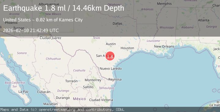
A 1.8 magnitude earthquake struck on 17 km ENE of Falls City, Texas, at Tue, 10 Feb 2026 21:42:49 GMT. Depth: 14.4619km. Reviewed by USGS seismologists, this minor quake occurred at a magnitude type of ml.
Magnitude
1.8
ml
Source
USGS
Intensity
-
Agency Reports
1 Sources| Source | Magnitude | Depth | Time |
|---|---|---|---|
| USGSPrimary | 1.8 | 14 km | 1 week ago |
Earthquake Details
AutomaticEvent IDusgs_tx2026cxcfww
Tsunami PotentialNo
Magnitude Typeml
Nearest Places
- 1.9 km
- 1.9 km
- 2.9 km
- 3.3 km
- 3.3 km
Comments
Join the discussion about this event.
Latest Earthquakes
3.7Mag
AEGEAN SEA
Time4 hours ago
Depth10.00 km
SourceNOA (Automatic)
1.4Mag
British Columbia, Canada
Time4 hours ago
Depth28.81 km
SourceVYT (Automatic)
1.8Mag
17 km N of Nixon, Texas
Time4 hours ago
Depth5.00 km
SourceUSGS (Automatic)
2.2Mag
Sumbawa Region, Indonesia
Time4 hours ago
Depth10.00 km
SourceBMKG
1.9Mag
offshore Valparaiso, Chile
Time4 hours ago
Depth20.02 km
SourceVYT (Automatic)
Nearby Earthquakes
1.8Mag
16 km ENE of Falls City, Texas
Time1 week ago
Depth9.03 km
SourceUSGS (Automatic)
1.6Mag
15 km ENE of Falls City, Texas
Time3 weeks ago
Depth7.85 km
SourceUSGS (Automatic)
1.7Mag
16 km ENE of Falls City, Texas
Time1 week ago
Depth8.24 km
SourceUSGS (Automatic)
3.0Mag
SOUTHERN TEXAS
Time2 years ago
Depth4.70 km
SourceTX (Automatic)
2.5Mag
SOUTHERN TEXAS
Time1 week ago
Depth5.00 km
SourceNEIC (Automatic)