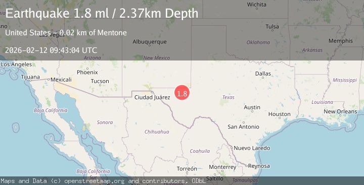
Earthquake 23 km W of Mentone, Texas
Thu, 12 Feb 2026 09:43:04 GMT
Time6 days ago
Location
31.6670, -103.8410
Depth
2.4 KM
Event Summary
A 1.8 magnitude earthquake struck on 23 km W of Mentone, Texas, at Thu, 12 Feb 2026 09:43:04 GMT. Depth: 2.372km. Reviewed by USGS seismologists, this minor quake occurred at a magnitude type of ml.
Magnitude
1.8
ml
Source
USGS
Intensity
-
Agency Reports
1 Sources| Source | Magnitude | Depth | Time |
|---|---|---|---|
| USGSPrimary | 1.8 | 2 km | 6 days ago |
Earthquake Details
AutomaticEvent IDusgs_tx2026czvvfk
Tsunami PotentialNo
Magnitude Typeml
Nearest Places
- Baumgardner Windmill1.7 km
- Hackberry Tank3.3 km
- W T Draw3.5 km
- Allarmarks Oil Field4.6 km
- Hackberry Windmill4.9 km
Comments
Join the discussion about this event.
Latest Earthquakes
1.7Mag
western Texas
Time4 minutes ago
Depth3.42 km
SourceVYT (Automatic)
3.5Mag
Seram, Indonesia
Time6 minutes ago
Depth0.00 km
SourceVYT (Automatic)
1.6Mag
54 km WNW of Toyah, Texas
Time12 minutes ago
Depth0.00 km
SourceUSGS (Automatic)
2.2Mag
West Papua Region, Indonesia
Time13 minutes ago
Depth26.69 km
SourceBMKG
1.2Mag
WESTERN TURKEY
Time14 minutes ago
Depth7.00 km
SourceAFAD (Automatic)
Nearby Earthquakes
1.7Mag
24 km W of Mentone, Texas
Time3 weeks ago
Depth0.00 km
SourceUSGS (Automatic)
0.6Mag
29 km WSW of Mentone, Texas
Time4 days ago
Depth0.00 km
SourceUSGS (Automatic)
5.0Mag
WESTERN TEXAS
Time5 years ago
Depth10.00 km
SourceEMSC (Automatic)
2.9Mag
WESTERN TEXAS
Time1 week ago
Depth7.30 km
SourceTX (Automatic)
3.0Mag
WESTERN TEXAS
Time4 years ago
Depth6.00 km
SourceTX (Automatic)