Earthquake 48 km NW of Toyah, Texas
Fri, 20 Feb 2026 00:35:20 GMT
Time1 day ago
Location
31.6020, -104.1770
Depth
0.9 KM
Event Summary
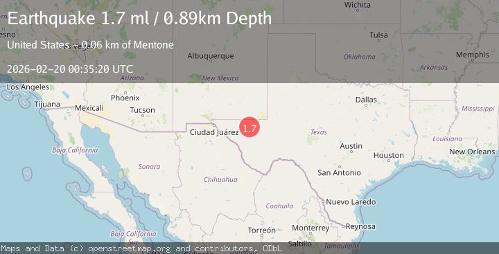
A 1.7 magnitude earthquake struck on 48 km NW of Toyah, Texas, at Fri, 20 Feb 2026 00:35:20 GMT. Depth: 0.8867km. Reviewed by USGS seismologists, this minor quake occurred at a magnitude type of ml.
Magnitude
1.7
ml
Source
USGS
Intensity
-
Agency Reports
1 Sources| Source | Magnitude | Depth | Time |
|---|---|---|---|
| USGSPrimary | 1.7 | 1 km | 1 day ago |
Earthquake Details
AutomaticEvent IDusgs_tx2026dnvmnj
Tsunami PotentialNo
Magnitude Typeml
Nearest Places
- 3.8 km
- 6.6 km
- 7.5 km
- 7.5 km
- 7.5 km
Comments
Join the discussion about this event.
Latest Earthquakes
2.2Mag
Minahasa, Sulawesi, Indonesia
Time7 minutes ago
Depth18.92 km
SourceVYT (Automatic)
3.2Mag
Andreanof Islands, Aleutian Islands, Alaska
Time10 minutes ago
Depth0.12 km
SourceVYT (Automatic)
2.3Mag
AZORES ISLANDS, PORTUGAL
Time11 minutes ago
Depth5.00 km
SourceIPMA (Automatic)
1.7Mag
21 km SE of Pāhala, Hawaii
Time11 minutes ago
Depth34.21 km
SourceUSGS (Automatic)
2.1Mag
Tarapaca, Chile
Time14 minutes ago
Depth100.10 km
SourceVYT (Automatic)
Nearby Earthquakes
2.2Mag
western Texas
Time2 days ago
Depth0.24 km
SourceVYT (Automatic)
1.6Mag
47 km NW of Toyah, Texas
Time2 weeks ago
Depth6.24 km
SourceUSGS
3.0Mag
WESTERN TEXAS
Time1 year ago
Depth2.50 km
SourceTX (Automatic)
1.9Mag
western Texas
Time2 hours ago
Depth0.00 km
SourceVYT (Automatic)
3.0Mag
WESTERN TEXAS
Time5 years ago
Depth5.00 km
SourceNEIC (Automatic)