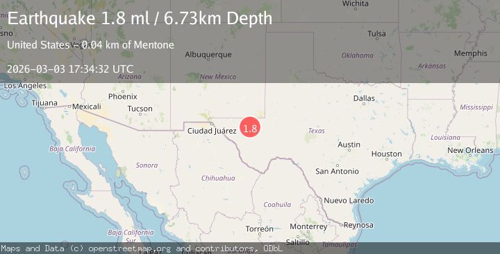
Earthquake 30 km NW of Toyah, Texas
Tue, 03 Mar 2026 17:34:32 GMT
Time1 hour ago
Location
31.5190, -104.0110
Depth
4.5 KM
Event Summary
A 1.7 magnitude earthquake struck on 30 km NW of Toyah, Texas, at Tue, 03 Mar 2026 17:34:32 GMT. Depth: 4.5489km. Reviewed by USGS seismologists, this minor quake occurred at a magnitude type of ml.
Magnitude
1.7
ml
Source
USGS
Intensity
-
Agency Reports
1 Sources| Source | Magnitude | Depth | Time |
|---|---|---|---|
| USGSPrimary | 1.7 | 5 km | 1 hour ago |
Earthquake Details
AutomaticEvent IDusgs_tx2026ejigko
Tsunami PotentialNo
Magnitude Typeml
Nearest Places
- 2.3 km
- 4.8 km
- 6.0 km
- 6.2 km
- 6.7 km
Comments
Join the discussion about this event.
Latest Earthquakes
2.4Mag
Washington
Time1 hour ago
Depth2.81 km
SourceVYT (Automatic)
2.2Mag
Southeastern Alaska
Time1 hour ago
Depth0.00 km
SourceVYT (Automatic)
1.4Mag
18 km ESE of Little Lake, CA
Time1 hour ago
Depth9.42 km
SourceUSGS (Automatic)
2.5Mag
Nevada
Time1 hour ago
Depth0.00 km
SourceVYT (Automatic)
2.3Mag
FRANCE-GERMANY BORDER REGION
Time1 hour ago
Depth20.00 km
SourceLED (Automatic)
Nearby Earthquakes
1.6Mag
30 km NW of Toyah, Texas
Time1 hour ago
Depth4.32 km
SourceUSGS (Automatic)
2.0Mag
WESTERN TEXAS
Time1 month ago
Depth4.70 km
SourceTX (Automatic)
1.4Mag
31 km NW of Toyah, Texas
Time1 week ago
Depth4.21 km
SourceUSGS (Automatic)
1.8Mag
31 km NW of Toyah, Texas
Time1 month ago
Depth3.43 km
SourceUSGS (Automatic)
0.4Mag
31 km NW of Toyah, Texas
Time1 week ago
Depth4.11 km
SourceUSGS (Automatic)