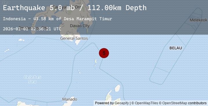
Earthquake 207 km SE of Pondaguitan, Philippines
Thu, 01 Jan 2026 02:56:21 GMT
Time5 hours ago
Location
4.9920, 127.4535
Depth
112.0 KM
Event Summary
A 5.0 magnitude earthquake struck on 207 km SE of Pondaguitan, Philippines, at Thu, 01 Jan 2026 02:56:21 GMT. Depth: 111.995km. Reviewed by USGS seismologists, this moderate quake occurred at a magnitude type of mb.
Magnitude
5.0
mb
Source
USGS
Intensity
-
Earthquake Details
ConfirmedEvent IDusgs_us7000rltp
Tsunami PotentialNo
Magnitude Typemb
Nearest Places
- Desa Marampit Timur43.5 km
- Desa Marampit44.2 km
- Kecamatan Nanusa44.8 km
- Pulau Marampit44.9 km
- Desa Dampulis45.2 km
Comments
Join the discussion about this event.
Latest Earthquakes
4.8Mag
West Papua, Indonesia
Time2 hours ago
Depth131.28 km
SourceBMKG (Automatic)
0.5Mag
6 km ENE of Aguanga, CA
Time2 hours ago
Depth12.44 km
SourceUSGS (Automatic)
0.8Mag
10 km NW of The Geysers, CA
Time2 hours ago
Depth1.77 km
SourceUSGS (Automatic)
2.3Mag
Sulawesi, Indonesia
Time2 hours ago
Depth5.00 km
SourceBMKG (Automatic)
5.0Mag
NEAR EAST COAST OF KAMCHATKA
Time2 hours ago
Depth5.40 km
SourceEMSC (Automatic)