Earthquake 111 km N of Yakutat, Alaska
Thu, 01 Jan 2026 11:15:57 GMT
Time1 hour ago
Location
60.5325, -140.1074
Depth
5.0 KM
Event Summary
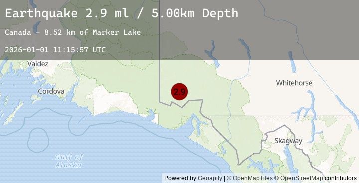
A 2.9 magnitude earthquake struck on 111 km N of Yakutat, Alaska, at Thu, 01 Jan 2026 11:15:57 GMT. Depth: 5km. Reviewed by USGS seismologists, this minor quake occurred at a magnitude type of ml.
Magnitude
2.9
ml
Source
USGS
Intensity
-
Earthquake Details
ConfirmedEvent IDusgs_us7000rlw5
Tsunami PotentialNo
Magnitude Typeml
Nearest Places
- Marker Lake6.9 km
- McArthur Peak10.1 km
- Mount Logan16.7 km
- Mount King George17.5 km
- Mount Queen Mary23.4 km
Comments
Join the discussion about this event.
Latest Earthquakes
5.0Mag
LAGO DE MARACAIBO, VENEZUELA
Time8 minutes ago
Depth35.00 km
SourceEMSC (Automatic)
2.3Mag
WESTERN AUSTRALIA
Time11 minutes ago
Depth1.00 km
SourceEMSC (Automatic)
2.2Mag
88 km E of McCarthy, Alaska
Time14 minutes ago
Depth5.00 km
SourceUSGS (Automatic)
2.2Mag
Java, Indonesia
Time21 minutes ago
Depth33.49 km
SourceBMKG (Automatic)
2.5Mag
Java, Indonesia
Time24 minutes ago
Depth10.00 km
SourceBMKG (Automatic)
Nearby Earthquakes
3.7Mag
109 km N of Yakutat, Alaska
Time45 minutes ago
Depth5.00 km
SourceUSGS
3.7Mag
SOUTHERN YUKON TERRITORY, CANADA
Time45 minutes ago
Depth5.00 km
SourceEMSC (Automatic)
2.9Mag
SOUTHERN YUKON TERRITORY, CANADA
Time1 hour ago
Depth5.00 km
SourceEMSC (Automatic)
1.9Mag
110 km NNW of Yakutat, Alaska
Time1 hour ago
Depth3.10 km
SourceUSGS
2.7Mag
SOUTHERN YUKON TERRITORY, CANADA
Time2 hours ago
Depth5.00 km
SourceEMSC (Automatic)