Earthquake California-Baja California border region
Thu, 12 Feb 2026 09:52:21 GMT
Time1 week ago
Location
32.7507, -115.8477
Depth
8.9 KM
Event Summary
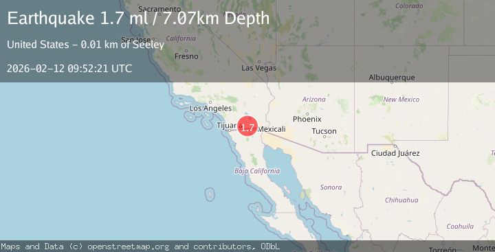
A 1.8 magnitude earthquake struck on California-Baja California border region, at Thu, 12 Feb 2026 09:52:21 GMT. Depth: 8.9111328125km. Reviewed by VYT seismologists, this minor quake occurred at a magnitude type of earthquake.
Magnitude
1.8
earthquake
Source
VYT
Intensity
-
Agency Reports
2 Sources| Source | Magnitude | Depth | Time |
|---|---|---|---|
| VYTPrimary | 1.8 | 9 km | 1 week ago |
| USGS | 1.7 | 7 km | 1 week ago |
Earthquake Details
AutomaticEvent IDvyt_15xgv7h5bc390
Tsunami PotentialNo
Magnitude Typeearthquake
Nearest Places
- Yuha Buttes1.5 km
- Shell Beds2.2 km
- Wixon Gravel Pit4.0 km
- Yuha Well4.7 km
- Plaster City4.8 km
Comments
Join the discussion about this event.
Latest Earthquakes
0.6Mag
12 km SE of Anza, CA
Time4 minutes ago
Depth6.49 km
SourceUSGS (Automatic)
2.6Mag
western Texas
Time6 minutes ago
Depth12.70 km
SourceVYT (Automatic)
2.0Mag
Sumbawa Region, Indonesia
Time7 minutes ago
Depth21.49 km
SourceBMKG
1.0Mag
Southern Alaska
Time8 minutes ago
Depth1.34 km
SourceVYT (Automatic)
1.7Mag
Dead Sea region
Time9 minutes ago
Depth0.00 km
SourceVYT (Automatic)
Nearby Earthquakes
2.5Mag
SOUTHERN CALIFORNIA
Time1 month ago
Depth10.00 km
SourceNEIC (Automatic)
3.0Mag
SOUTHERN CALIFORNIA
Time2 years ago
Depth13.20 km
SourceNEIC (Automatic)
3.0Mag
SOUTHERN CALIFORNIA
Time7 years ago
Depth10.00 km
SourceNEIC (Automatic)
3.0Mag
SOUTHERN CALIFORNIA
Time9 years ago
Depth10.00 km
SourceNEIC (Automatic)
1.7Mag
California-Baja California border region
Time6 days ago
Depth2.69 km
SourceVYT (Automatic)