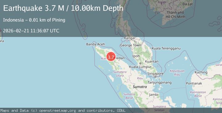
Earthquake northern Sumatra, Indonesia
Sat, 21 Feb 2026 11:36:07 GMT
Time1 hour ago
Location
4.0834, 97.2281
Depth
25.5 KM
Event Summary
A 3.4 magnitude earthquake struck on northern Sumatra, Indonesia, at Sat, 21 Feb 2026 11:36:07 GMT. Depth: 25.5126953125km. Reviewed by VYT seismologists, this minor quake occurred at a magnitude type of earthquake.
Magnitude
3.4
earthquake
Source
VYT
Intensity
-
Agency Reports
1 Sources| Source | Magnitude | Depth | Time |
|---|---|---|---|
| VYTPrimary | 3.4 | 26 km | 1 hour ago |
Earthquake Details
AutomaticEvent IDvyt_17554xxg85zbt
Tsunami PotentialNo
Magnitude Typeearthquake
Nearest Places
- 0.8 km
- 1.3 km
- 1.5 km
- 1.7 km
- 1.9 km
Comments
Join the discussion about this event.
Latest Earthquakes
1.2Mag
14 km ESE of Little Lake, CA
Time1 hour ago
Depth1.71 km
SourceUSGS (Automatic)
1.4Mag
Central Alaska
Time1 hour ago
Depth0.00 km
SourceVYT (Automatic)
2.0Mag
Sweden
Time1 hour ago
Depth5.98 km
SourceVYT (Automatic)
3.9Mag
Mindanao, Philippines
Time1 hour ago
Depth10.00 km
SourceBMKG
2.4Mag
Antofagasta, Chile
Time1 hour ago
Depth61.28 km
SourceVYT (Automatic)
Nearby Earthquakes
3.0Mag
NORTHERN SUMATRA, INDONESIA
Time5 months ago
Depth10.00 km
SourceBMKG (Automatic)
3.0Mag
NORTHERN SUMATRA, INDONESIA
Time3 years ago
Depth10.00 km
SourceDJA (Automatic)
2.5Mag
Northern Sumatra, Indonesia
Time1 week ago
Depth5.00 km
SourceBMKG (Automatic)
5.0Mag
NORTHERN SUMATRA, INDONESIA
Time5 years ago
Depth114.00 km
SourceEMSC (Automatic)
2.2Mag
Northern Sumatra, Indonesia
Time2 weeks ago
Depth3.77 km
SourceBMKG (Automatic)