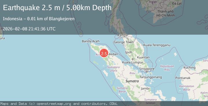
Earthquake Northern Sumatra, Indonesia
Sun, 08 Feb 2026 21:41:36 GMT
Time1 hour ago
Location
4.1457, 97.3962
Depth
5.0 KM
Event Summary
A 2.3 magnitude earthquake struck on Northern Sumatra, Indonesia, at Sun, 08 Feb 2026 21:41:36 GMT. Depth: 5km. Reviewed by BMKG seismologists, this minor quake occurred at a magnitude type of M.
Magnitude
2.3
M
Source
BMKG
Intensity
-
Agency Reports
1 Sources| Source | Magnitude | Depth | Time |
|---|---|---|---|
| BMKGPrimary | 2.3 | 5 km | 1 hour ago |
Earthquake Details
AutomaticEvent IDbmg2026ctcb
Tsunami PotentialNo
Magnitude TypeM
Nearest Places
- Burni Apitan1.8 km
- Burni Pepelar1.9 km
- Burni Siluman2.6 km
- Van Daalen Mountains2.7 km
- Burni Ujemulu3.7 km
Comments
Join the discussion about this event.
Latest Earthquakes
2.6Mag
Java, Indonesia
Time1 hour ago
Depth20.10 km
SourceBMKG (Automatic)
1.6Mag
10 km ENE of Goldfield, Nevada
Time1 hour ago
Depth0.02 km
SourceUSGS (Automatic)
0.8Mag
5 km WNW of The Geysers, CA
Time1 hour ago
Depth3.09 km
SourceUSGS (Automatic)
2.7Mag
SAN JUAN, ARGENTINA
Time1 hour ago
Depth76.00 km
SourceNSNA (Automatic)
2.1Mag
Sumbawa Region, Indonesia
Time1 hour ago
Depth120.31 km
SourceBMKG (Automatic)
Nearby Earthquakes
2.9Mag
Northern Sumatra, Indonesia
Time2 days ago
Depth3.00 km
SourceBMKG (Automatic)
2.9Mag
Northern Sumatra, Indonesia
Time13 hours ago
Depth1.00 km
SourceBMKG (Automatic)
2.2Mag
Northern Sumatra, Indonesia
Time1 day ago
Depth3.77 km
SourceBMKG (Automatic)
3.0Mag
Northern Sumatra, Indonesia
Time1 week ago
Depth5.00 km
SourceBMKG (Automatic)
2.2Mag
Northern Sumatra, Indonesia
Time2 weeks ago
Depth2.00 km
SourceBMKG (Automatic)