Earthquake Northern Territory, Australia
Tue, 17 Feb 2026 08:04:12 GMT
Time2 days ago
Location
-12.4127, 136.0312
Depth
127.9 KM
Event Summary
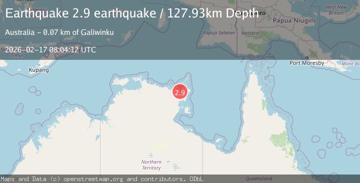
A 2.9 magnitude earthquake struck on Northern Territory, Australia, at Tue, 17 Feb 2026 08:04:12 GMT. Depth: 127.9296875km. Reviewed by VYT seismologists, this minor quake occurred at a magnitude type of earthquake.
Magnitude
2.9
earthquake
Source
VYT
Intensity
-
Agency Reports
1 Sources| Source | Magnitude | Depth | Time |
|---|---|---|---|
| VYTPrimary | 2.9 | 128 km | 2 days ago |
Earthquake Details
AutomaticEvent IDvyt_1906rxh4sl9w4
Tsunami PotentialNo
Magnitude Typeearthquake
Nearest Places
- Habgood River5.0 km
- Ramungir Bay5.5 km
- Ganumbali Island6.9 km
- Raymangirr8.6 km
- Raymangirr8.6 km
Comments
Join the discussion about this event.
Latest Earthquakes
2.1Mag
Tarapaca, Chile
Time58 seconds ago
Depth0.24 km
SourceVYT (Automatic)
3.1Mag
OKLAHOMA
Time6 minutes ago
Depth1.00 km
SourceOK (Automatic)
2.3Mag
western Texas
Time6 minutes ago
Depth0.00 km
SourceVYT (Automatic)
2.7Mag
Southeastern Alaska
Time8 minutes ago
Depth6.35 km
SourceVYT (Automatic)
2.4Mag
Poland
Time8 minutes ago
Depth4.64 km
SourceVYT (Automatic)
Nearby Earthquakes
4.8Mag
Northern Territory, Australia
Time2 hours ago
Depth10.00 km
SourceVYT (Automatic)
3.5Mag
Northern Territory, Australia
Time1 week ago
Depth722.05 km
SourceVYT (Automatic)
3.4Mag
near the south coast of Papua, Indonesia
Time4 days ago
Depth383.30 km
SourceVYT (Automatic)
4.7Mag
ARAFURA SEA
Time1 month ago
Depth10.00 km
SourceEMSC (Automatic)
5.0Mag
ARAFURA SEA
Time4 years ago
Depth10.00 km
SourceEMSC (Automatic)