Earthquake Southern Alaska
Fri, 13 Feb 2026 05:19:01 GMT
Time5 days ago
Location
61.1727, -145.0031
Depth
0.0 KM
Event Summary
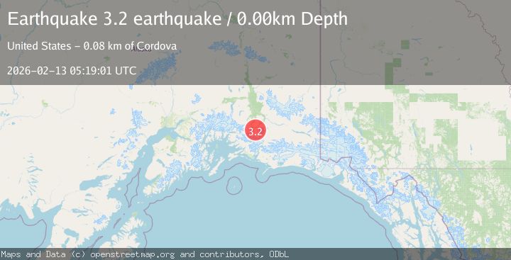
A 3.2 magnitude earthquake struck on Southern Alaska, at Fri, 13 Feb 2026 05:19:01 GMT. Depth: 0km. Reviewed by VYT seismologists, this minor quake occurred at a magnitude type of earthquake.
Magnitude
3.2
earthquake
Source
VYT
Intensity
-
Agency Reports
1 Sources| Source | Magnitude | Depth | Time |
|---|---|---|---|
| VYTPrimary | 3.2 | 0 km | 5 days ago |
Earthquake Details
AutomaticEvent IDvyt_1l5rsbvc9mq4c
Tsunami PotentialNo
Magnitude Typeearthquake
Nearest Places
- Thunder Creek4.8 km
- Cleave Creek7.0 km
- Jackson Creek9.3 km
- Tiekel River9.4 km
- Dewey Creek10.4 km
Comments
Join the discussion about this event.
Latest Earthquakes
3.2Mag
Antofagasta, Chile
Time8 minutes ago
Depth124.27 km
SourceVYT (Automatic)
1.7Mag
Kenai Peninsula, Alaska
Time14 minutes ago
Depth28.44 km
SourceVYT (Automatic)
1.7Mag
Tarapaca, Chile
Time17 minutes ago
Depth6.47 km
SourceVYT (Automatic)
1.9Mag
Central Alaska
Time19 minutes ago
Depth81.18 km
SourceVYT (Automatic)
1.2Mag
21 km ENE of Little Lake, CA
Time20 minutes ago
Depth0.90 km
SourceUSGS (Automatic)
Nearby Earthquakes
3.0Mag
SOUTHERN ALASKA
Time7 years ago
Depth16.00 km
SourceNEIR (Automatic)
1.9Mag
Southern Alaska
Time1 week ago
Depth7.45 km
SourceVYT (Automatic)
2.8Mag
SOUTHERN ALASKA
Time1 month ago
Depth35.00 km
SourceNEIC (Automatic)
1.1Mag
Southern Alaska
Time1 day ago
Depth5.37 km
SourceVYT (Automatic)
1.5Mag
36 km WSW of Tonsina, Alaska
Time3 weeks ago
Depth41.60 km
SourceUSGS (Automatic)