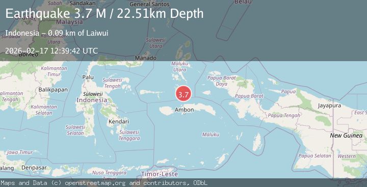
Earthquake Halmahera, Indonesia
Tue, 17 Feb 2026 12:39:41 GMT
Time22 hours ago
Location
-1.9347, 128.1626
Depth
11.2 KM
Event Summary
A 4.1 magnitude earthquake struck on Halmahera, Indonesia, at Tue, 17 Feb 2026 12:39:41 GMT. Depth: 11.23046875km. Reviewed by VYT seismologists, this light quake occurred at a magnitude type of earthquake.
Magnitude
4.1
earthquake
Source
VYT
Intensity
-
Agency Reports
1 Sources| Source | Magnitude | Depth | Time |
|---|---|---|---|
| VYTPrimary | 4.1 | 11 km | 22 hours ago |
Earthquake Details
AutomaticEvent IDvyt_1rwv7jy23eyw6
Tsunami PotentialNo
Magnitude Typeearthquake
Nearest Places
- Ake Mela-ici26.4 km
- Tanjung Wooi Kecil27.9 km
- Tanjung Serammaloleo27.9 km
- Selat Tobalai32.7 km
- Desa Wooi32.7 km
Comments
Join the discussion about this event.
Latest Earthquakes
2.1Mag
Spain
Time22 hours ago
Depth6.47 km
SourceVYT (Automatic)
1.6Mag
52 km NW of Toyah, Texas
Time22 hours ago
Depth0.00 km
SourceUSGS (Automatic)
2.9Mag
Potosi, Bolivia
Time22 hours ago
Depth176.64 km
SourceVYT (Automatic)
2.3Mag
West Papua Region, Indonesia
Time22 hours ago
Depth78.34 km
SourceBMKG
1.1Mag
WESTERN TURKEY
Time22 hours ago
Depth7.00 km
SourceAFAD (Automatic)
Nearby Earthquakes
6.0Mag
KEPULAUAN OBI, INDONESIA
Time15 years ago
Depth48.00 km
SourceEMSC (Automatic)
3.0Mag
KEPULAUAN OBI, INDONESIA
Time4 months ago
Depth15.00 km
SourceBMKG (Automatic)
3.0Mag
KEPULAUAN OBI, INDONESIA
Time3 years ago
Depth57.00 km
SourceDJA (Automatic)
5.4Mag
CERAM SEA, INDONESIA
Time18 years ago
Depth40.00 km
SourceEMSC (Automatic)
4.0Mag
KEPULAUAN OBI, INDONESIA
Time6 years ago
Depth10.00 km
SourceNEIC (Automatic)