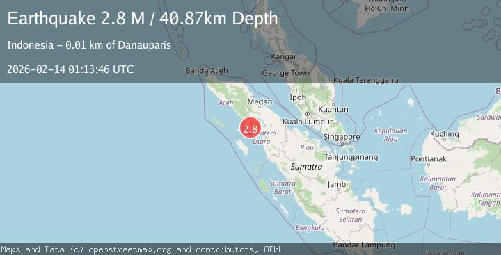
Earthquake northern Sumatra, Indonesia
Sat, 14 Feb 2026 01:13:49 GMT
Time4 days ago
Location
2.6320, 98.1600
Depth
48.5 KM
Event Summary
A 2.8 magnitude earthquake struck on northern Sumatra, Indonesia, at Sat, 14 Feb 2026 01:13:49 GMT. Depth: 48.4619140625km. Reviewed by VYT seismologists, this minor quake occurred at a magnitude type of earthquake.
Magnitude
2.8
earthquake
Source
VYT
Intensity
-
Agency Reports
2 Sources| Source | Magnitude | Depth | Time |
|---|---|---|---|
| VYTPrimary | 2.5 | 48 km | 4 days ago |
| BMKG | 2.8 | 41 km | 4 days ago |
Earthquake Details
AutomaticEvent IDvyt_1shkk9invfxa5
Tsunami PotentialNo
Magnitude Typeearthquake
Nearest Places
- Dolok Raja Maninjou1.9 km
- Lae Paku2.6 km
- Lae Baning3.0 km
- Desa Kaban Tengah3.1 km
- Lae Pakupola3.6 km
Comments
Join the discussion about this event.
Latest Earthquakes
2.6Mag
Sumbawa region, Indonesia
Time20 hours ago
Depth155.40 km
SourceVYT (Automatic)
2.3Mag
near the coast of Tarapaca, Chile
Time20 hours ago
Depth20.02 km
SourceVYT (Automatic)
1.6Mag
northwestern Russia
Time20 hours ago
Depth0.00 km
SourceVYT (Automatic)
5.0Mag
Andreanof Islands, Aleutian Islands, Alaska
Time20 hours ago
Depth32.84 km
SourceVYT (Automatic)
4.9Mag
Andreanof Islands, Aleutian Islands, Alaska
Time20 hours ago
Depth18.92 km
SourceVYT (Automatic)
Nearby Earthquakes
5.3Mag
NORTHERN SUMATRA, INDONESIA
Time19 years ago
Depth68.00 km
SourceEMSC (Automatic)
2.5Mag
NORTHERN SUMATRA, INDONESIA
Time2 weeks ago
Depth144.00 km
SourceBMKG (Automatic)
2.1Mag
Northern Sumatra, Indonesia
Time3 weeks ago
Depth12.54 km
SourceBMKG (Automatic)
3.5Mag
NORTHERN SUMATRA, INDONESIA
Time1 month ago
Depth64.00 km
SourceBMKG (Automatic)
2.4Mag
Northern Sumatra, Indonesia
Time1 week ago
Depth64.64 km
SourceBMKG (Automatic)