Earthquake Timor region, Indonesia
Sat, 14 Feb 2026 05:54:51 GMT
Time6 days ago
Location
-8.9254, 124.4431
Depth
11.1 KM
Event Summary
A 3.4 magnitude earthquake struck on Timor region, Indonesia, at Sat, 14 Feb 2026 05:54:51 GMT. Depth: 11.1083984375km. Reviewed by VYT seismologists, this minor quake occurred at a magnitude type of earthquake.
Magnitude
3.4
earthquake
Source
VYT
Intensity
-
Agency Reports
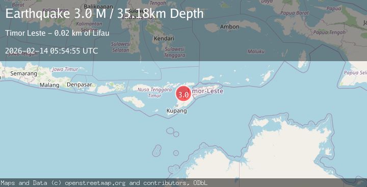
2 Sources| Source | Magnitude | Depth | Time |
|---|---|---|---|
| VYTPrimary | 3.4 | 11 km | 6 days ago |
| BMKG | 3.0 | 35 km | 6 days ago |
Earthquake Details
AutomaticEvent IDvyt_24dd4a3kosxh9
Tsunami PotentialNo
Magnitude Typeearthquake
Nearest Places
- Tanjung Sakato26.9 km
- Nipane26.9 km
- Point Lubanbatu27.0 km
- Fatuputi27.2 km
- Oebone27.2 km
Comments
Join the discussion about this event.
Latest Earthquakes
1.2Mag
9 km N of Banning, CA
Time6 hours ago
Depth18.03 km
SourceUSGS (Automatic)
2.1Mag
Southern California
Time6 hours ago
Depth8.54 km
SourceVYT (Automatic)
2.2Mag
Sweden
Time6 hours ago
Depth0.00 km
SourceVYT (Automatic)
2.6Mag
West Papua Region, Indonesia
Time6 hours ago
Depth14.47 km
SourceBMKG
1.9Mag
5 km SSE of Pāhala, Hawaii
Time6 hours ago
Depth32.73 km
SourceUSGS (Automatic)
Nearby Earthquakes
4.0Mag
TIMOR REGION
Time1 month ago
Depth10.00 km
SourceBMKG (Automatic)
3.0Mag
KEPULAUAN ALOR, INDONESIA
Time4 years ago
Depth10.00 km
SourceDJA (Automatic)
3.1Mag
KEPULAUAN ALOR, INDONESIA
Time1 month ago
Depth143.00 km
SourceBMKG (Automatic)
3.0Mag
KEPULAUAN ALOR, INDONESIA
Time4 years ago
Depth78.00 km
SourceDJA (Automatic)
3.0Mag
KEPULAUAN ALOR, INDONESIA
Time3 years ago
Depth115.00 km
SourceDJA (Automatic)