Earthquake Kenai Peninsula, Alaska
Fri, 06 Mar 2026 03:26:31 GMT
Time2 hours ago
Location
60.1673, -148.5184
Depth
9.8 KM
Event Summary
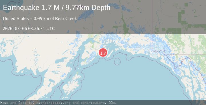
A 1.7 magnitude earthquake struck on Kenai Peninsula, Alaska, at Fri, 06 Mar 2026 03:26:31 GMT. Depth: 9.765625km. Reviewed by VYT seismologists, this minor quake occurred at a magnitude type of M.
Magnitude
1.7
M
Source
VYT
Intensity
-
Agency Reports
1 Sources| Source | Magnitude | Depth | Time |
|---|---|---|---|
| VYTPrimary | 1.7 | 10 km | 2 hours ago |
Earthquake Details
AutomaticEvent IDvyt_26pgr9q7kcjhz
Tsunami PotentialNo
Magnitude TypeM
Nearest Places
- 1.7 km
- 5.2 km
- 7.5 km
- 9.1 km
- 10.2 km
Comments
Join the discussion about this event.
Latest Earthquakes
2.5Mag
Southern Alaska
Time18 minutes ago
Depth61.40 km
SourceVYT (Automatic)
1.4Mag
Southern Alaska
Time22 minutes ago
Depth11.23 km
SourceVYT (Automatic)
0.6Mag
53 km W of Indian Springs, Nevada
Time23 minutes ago
Depth6.77 km
SourceUSGS (Automatic)
4.2Mag
Kepulauan Talaud, Indonesia
Time24 minutes ago
Depth58.47 km
SourceVYT (Automatic)
2.9Mag
Potosi, Bolivia
Time27 minutes ago
Depth148.93 km
SourceVYT (Automatic)
Nearby Earthquakes
2.6Mag
KENAI PENINSULA, ALASKA
Time3 weeks ago
Depth22.70 km
SourceNEIC (Automatic)
2.4Mag
Kenai Peninsula, Alaska
Time6 days ago
Depth0.00 km
SourceVYT (Automatic)
2.0Mag
Kenai Peninsula, Alaska
Time1 week ago
Depth144.90 km
SourceVYT (Automatic)
2.3Mag
Kenai Peninsula, Alaska
Time1 week ago
Depth10.86 km
SourceVYT (Automatic)
1.7Mag
Kenai Peninsula, Alaska
Time2 weeks ago
Depth12.33 km
SourceVYT (Automatic)