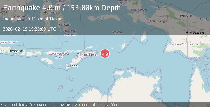
Earthquake Timor Sea
Thu, 19 Feb 2026 19:26:09 GMT
Time2 hours ago
Location
-8.5773, 128.5435
Depth
164.2 KM
Event Summary
A 3.6 magnitude earthquake struck on Timor Sea, at Thu, 19 Feb 2026 19:26:09 GMT. Depth: 164.1845703125km. Reviewed by VYT seismologists, this minor quake occurred at a magnitude type of earthquake.
Magnitude
3.6
earthquake
Source
VYT
Intensity
-
Agency Reports
1 Sources| Source | Magnitude | Depth | Time |
|---|---|---|---|
| VYTPrimary | 3.6 | 164 km | 2 hours ago |
Earthquake Details
AutomaticEvent IDvyt_2ldbg9z1f7mht
Tsunami PotentialNo
Magnitude Typeearthquake
Nearest Places
- Pulau Jagatutur25.4 km
- Pulau Jagattutun25.7 km
- Pulau Meatimiarang27.3 km
- Meatiy Miarang Lighthouse27.6 km
- Pulau Morau27.9 km
Comments
Join the discussion about this event.
Latest Earthquakes
2.1Mag
NORTHERN CALIFORNIA
Time2 hours ago
Depth6.60 km
SourceNC (Automatic)
3.6Mag
Eastern Anatolia Region, Turkey
Time2 hours ago
Depth10.00 km
SourceVYT (Automatic)
2.9Mag
South of Java, Indonesia
Time2 hours ago
Depth24.70 km
SourceBMKG
2.5Mag
near the coast of Tarapaca, Chile
Time2 hours ago
Depth138.55 km
SourceVYT (Automatic)
2.6Mag
Seram, Indonesia
Time2 hours ago
Depth31.25 km
SourceVYT (Automatic)
Nearby Earthquakes
5.0Mag
TIMOR SEA
Time17 years ago
Depth100.00 km
SourceEMSC (Automatic)
5.0Mag
TIMOR SEA
Time3 years ago
Depth10.00 km
SourceEMSC (Automatic)
3.5Mag
Timor Sea
Time1 week ago
Depth182.50 km
SourceVYT (Automatic)
5.1Mag
TIMOR SEA
Time18 years ago
Depth20.00 km
SourceEMSC (Automatic)
6.1Mag
TIMOR SEA
Time18 years ago
Depth10.00 km
SourceEMSC (Automatic)