Earthquake TIMOR SEA
Wed, 13 Feb 2008 19:58:44 GMT
Time18 years ago
Location
-8.2300, 128.7000
Depth
10.0 KM
Event Summary
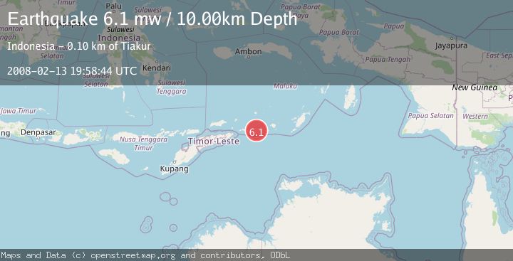
A 6.1 magnitude earthquake struck on TIMOR SEA, at Wed, 13 Feb 2008 19:58:44 GMT. Depth: 10km. Reviewed by EMSC seismologists, this strong quake occurred at a magnitude type of mw.
Magnitude
6.1
mw
Source
EMSC
Intensity
-
Agency Reports
1 Sources| Source | Magnitude | Depth | Time |
|---|---|---|---|
| EMSCPrimary | 6.1 | 10 km | 18 years ago |
Earthquake Details
AutomaticEvent IDemsc_EMSC_20080213_0000080
Tsunami PotentialNo
Magnitude Typemw
Nearest Places
- Pulau Matumara3.8 km
- Pulau Warwawang4.5 km
- Gunung Woropelafka5.2 km
- Desa Luang Barat5.3 km
- Tanjung Ilimarang5.5 km
Comments
Join the discussion about this event.
Latest Earthquakes
1.4Mag
17 km S of Tres Pinos, CA
Time4 minutes ago
Depth5.12 km
SourceUSGS (Automatic)
1.8Mag
Southern Alaska
Time6 minutes ago
Depth0.00 km
SourceVYT (Automatic)
2.0Mag
Java, Indonesia
Time12 minutes ago
Depth5.00 km
SourceBMKG
0.7Mag
2 km SE of Loma Linda, CA
Time20 minutes ago
Depth3.87 km
SourceUSGS (Automatic)
2.3Mag
Sulawesi, Indonesia
Time21 minutes ago
Depth5.74 km
SourceBMKG
Nearby Earthquakes
5.1Mag
TIMOR SEA
Time18 years ago
Depth20.00 km
SourceEMSC (Automatic)
4.1Mag
Timor Sea
Time5 days ago
Depth180.66 km
SourceVYT (Automatic)
5.0Mag
TIMOR SEA
Time3 years ago
Depth54.00 km
SourceEMSC (Automatic)
5.4Mag
KEPULAUAN BABAR, INDONESIA
Time20 years ago
Depth2.00 km
SourceEMSC (Automatic)
3.8Mag
Timor Sea
Time1 week ago
Depth146.81 km
SourceBMKG