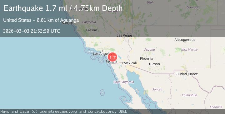
Earthquake Southern California
Tue, 03 Mar 2026 21:52:50 GMT
Time2 hours ago
Location
33.3264, -116.8271
Depth
14.9 KM
Event Summary
A 1.7 magnitude earthquake struck on Southern California, at Tue, 03 Mar 2026 21:52:50 GMT. Depth: 14.892578125km. Reviewed by VYT seismologists, this minor quake occurred at a magnitude type of M.
Magnitude
1.7
M
Source
VYT
Intensity
-
Agency Reports
2 Sources| Source | Magnitude | Depth | Time |
|---|---|---|---|
| VYTPrimary | 1.7 | 15 km | 2 hours ago |
| USGS | 1.7 | 5 km | 2 hours ago |
Earthquake Details
AutomaticEvent IDvyt_2tx3gj7fcojz3
Tsunami PotentialNo
Magnitude TypeM
Nearest Places
- 1.0 km
- 1.4 km
- 1.9 km
- 2.1 km
- 2.5 km
Comments
Join the discussion about this event.
Latest Earthquakes
1.8Mag
Kenai Peninsula, Alaska
Time1 hour ago
Depth12.21 km
SourceVYT (Automatic)
3.7Mag
Tarapaca, Chile
Time2 hours ago
Depth57.01 km
SourceVYT (Automatic)
3.2Mag
Northern Molucca Sea
Time2 hours ago
Depth10.65 km
SourceBMKG
4.7Mag
Rat Islands, Aleutian Islands, Alaska
Time2 hours ago
Depth10.00 km
SourceVYT (Automatic)
2.8Mag
Greece-Albania border region
Time2 hours ago
Depth14.16 km
SourceVYT (Automatic)
Nearby Earthquakes
1.1Mag
5 km ESE of Palomar Observatory, CA
Time3 days ago
Depth5.90 km
SourceUSGS (Automatic)
0.4Mag
4 km ESE of Palomar Observatory, CA
Time1 day ago
Depth4.72 km
SourceUSGS (Automatic)
1.2Mag
Southern California
Time2 days ago
Depth0.12 km
SourceVYT (Automatic)
0.4Mag
8 km SSE of Palomar Observatory, CA
Time2 weeks ago
Depth15.36 km
SourceUSGS (Automatic)
1.3Mag
8 km ESE of Palomar Observatory, CA
Time6 days ago
Depth16.87 km
SourceUSGS (Automatic)