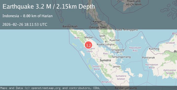
Earthquake northern Sumatra, Indonesia
Thu, 26 Feb 2026 18:11:52 GMT
Time6 hours ago
Location
2.6690, 98.6478
Depth
6.3 KM
Event Summary
A 3.5 magnitude earthquake struck on northern Sumatra, Indonesia, at Thu, 26 Feb 2026 18:11:52 GMT. Depth: 6.34765625km. Reviewed by VYT seismologists, this minor quake occurred at a magnitude type of earthquake.
Magnitude
3.5
earthquake
Source
VYT
Intensity
-
Agency Reports
1 Sources| Source | Magnitude | Depth | Time |
|---|---|---|---|
| VYTPrimary | 3.5 | 6 km | 6 hours ago |
Earthquake Details
AutomaticEvent IDvyt_2xt7fllv8lzsy
Tsunami PotentialNo
Magnitude Typeearthquake
Nearest Places
- 2.9 km
- 2.9 km
- 3.6 km
- 4.1 km
- 4.2 km
Comments
Join the discussion about this event.
Latest Earthquakes
2.4Mag
Antofagasta, Chile
Time6 hours ago
Depth37.11 km
SourceVYT (Automatic)
3.1Mag
Sweden
Time6 hours ago
Depth0.00 km
SourceVYT (Automatic)
2.3Mag
WESTERN TURKEY
Time6 hours ago
Depth16.50 km
SourceKOERI (Automatic)
2.1Mag
Tarapaca, Chile
Time6 hours ago
Depth65.06 km
SourceVYT (Automatic)
1.7Mag
Central Alaska
Time6 hours ago
Depth12.21 km
SourceVYT (Automatic)
Nearby Earthquakes
2.2Mag
Northern Sumatra, Indonesia
Time0 months ago
Depth11.65 km
SourceBMKG (Automatic)
2.5Mag
Northern Sumatra, Indonesia
Time3 days ago
Depth4.57 km
SourceBMKG
2.2Mag
Northern Sumatra, Indonesia
Time3 weeks ago
Depth6.49 km
SourceBMKG (Automatic)
2.1Mag
Northern Sumatra, Indonesia
Time0 months ago
Depth3.24 km
SourceBMKG (Automatic)
2.5Mag
Northern Sumatra, Indonesia
Time1 month ago
Depth4.40 km
SourceBMKG (Automatic)