Earthquake 4 km SSE of Banning, CA
Wed, 18 Feb 2026 01:56:43 GMT
Time7 hours ago
Location
33.8942, -116.8542
Depth
12.8 KM
Event Summary
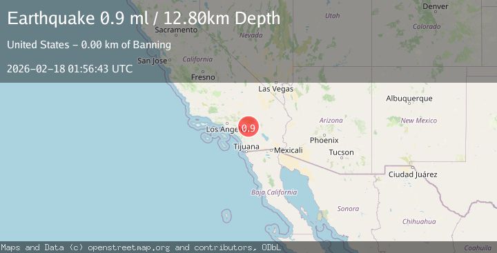
A 0.9 magnitude earthquake struck on 4 km SSE of Banning, CA, at Wed, 18 Feb 2026 01:56:43 GMT. Depth: 12.8km. Reviewed by USGS seismologists, this minor quake occurred at a magnitude type of ml.
Magnitude
0.9
ml
Source
USGS
Intensity
-
Agency Reports
1 Sources| Source | Magnitude | Depth | Time |
|---|---|---|---|
| USGSPrimary | 0.9 | 13 km | 7 hours ago |
Earthquake Details
AutomaticEvent IDusgs_ci41187375
Tsunami PotentialNo
Magnitude Typeml
Nearest Places
- Barker Peak2.0 km
- Barker Peak Lookout2.0 km
- Riverside County Sheriff's Department2.2 km
- Riverside County Road Camp2.4 km
- McMullen Flat2.8 km
Comments
Join the discussion about this event.
Latest Earthquakes
2.1Mag
Southern Alaska
Time4 minutes ago
Depth67.26 km
SourceVYT (Automatic)
2.2Mag
western Russia
Time7 minutes ago
Depth0.00 km
SourceVYT (Automatic)
1.5Mag
4 km NNW of The Geysers, CA
Time8 minutes ago
Depth-0.27 km
SourceUSGS (Automatic)
1.0Mag
9 km WNW of Two Rivers, Alaska
Time9 minutes ago
Depth5.70 km
SourceUSGS (Automatic)
2.9Mag
NORTHERN CALIFORNIA
Time10 minutes ago
Depth0.10 km
SourceNC (Automatic)
Nearby Earthquakes
1.1Mag
4 km SSE of Banning, CA
Time14 hours ago
Depth15.73 km
SourceUSGS (Automatic)
4.0Mag
Southern California
Time14 hours ago
Depth20.39 km
SourceVYT (Automatic)
2.3Mag
SOUTHERN CALIFORNIA
Time1 month ago
Depth6.70 km
SourceSCSN (Automatic)
3.0Mag
SOUTHERN CALIFORNIA
Time7 years ago
Depth6.00 km
SourceNEIC (Automatic)
1.4Mag
Southern California
Time5 days ago
Depth4.64 km
SourceVYT (Automatic)