Earthquake northern Sumatra, Indonesia
Tue, 17 Feb 2026 14:16:51 GMT
Time17 hours ago
Location
3.0816, 97.7072
Depth
30.3 KM
Event Summary
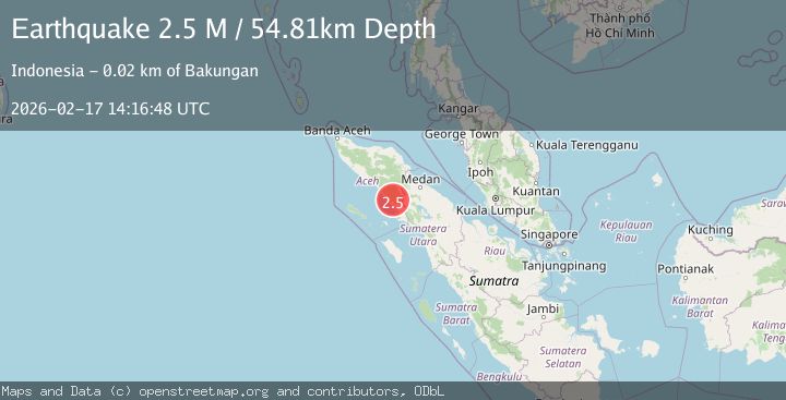
A 2.5 magnitude earthquake struck on northern Sumatra, Indonesia, at Tue, 17 Feb 2026 14:16:51 GMT. Depth: 30.2734375km. Reviewed by VYT seismologists, this minor quake occurred at a magnitude type of earthquake.
Magnitude
2.5
earthquake
Source
VYT
Intensity
-
Agency Reports
1 Sources| Source | Magnitude | Depth | Time |
|---|---|---|---|
| VYTPrimary | 2.5 | 30 km | 17 hours ago |
Earthquake Details
AutomaticEvent IDvyt_31fc70uc91e48
Tsunami PotentialNo
Magnitude Typeearthquake
Nearest Places
- Sembah Bala4.9 km
- Gampong Bunbun Indah8.5 km
- Gampong Lawe Sekhakut8.7 km
- Kecamatan Leuser9.0 km
- Gampong Tuah Kekhine9.1 km
Comments
Join the discussion about this event.
Latest Earthquakes
2.3Mag
Poland
Time17 hours ago
Depth6.35 km
SourceVYT (Automatic)
2.3Mag
Halmahera, Indonesia
Time17 hours ago
Depth75.30 km
SourceBMKG
2.5Mag
offshore Valparaiso, Chile
Time17 hours ago
Depth11.47 km
SourceVYT (Automatic)
1.7Mag
Central Alaska
Time17 hours ago
Depth0.00 km
SourceVYT (Automatic)
1.0Mag
6 km NNE of Four Mile Road, Alaska
Time18 hours ago
Depth2.00 km
SourceUSGS (Automatic)
Nearby Earthquakes
3.0Mag
NORTHERN SUMATRA, INDONESIA
Time10 months ago
Depth10.00 km
SourceBMKG (Automatic)
2.5Mag
NORTHERN SUMATRA, INDONESIA
Time1 month ago
Depth4.00 km
SourceBMKG (Automatic)
3.0Mag
NORTHERN SUMATRA, INDONESIA
Time3 years ago
Depth47.00 km
SourceDJA (Automatic)
6.1Mag
NORTHERN SUMATRA, INDONESIA
Time13 years ago
Depth93.00 km
SourceEMSC (Automatic)
5.0Mag
NORTHERN SUMATRA, INDONESIA
Time20 years ago
Depth33.00 km
SourceEMSC (Automatic)