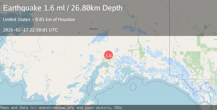
Earthquake Southern Alaska
Tue, 17 Feb 2026 22:50:03 GMT
Time10 hours ago
Location
61.8584, -150.3571
Depth
69.7 KM
Event Summary
A 1.7 magnitude earthquake struck on Southern Alaska, at Tue, 17 Feb 2026 22:50:03 GMT. Depth: 69.7021484375km. Reviewed by VYT seismologists, this minor quake occurred at a magnitude type of earthquake.
Magnitude
1.7
earthquake
Source
VYT
Intensity
-
Agency Reports
1 Sources| Source | Magnitude | Depth | Time |
|---|---|---|---|
| VYTPrimary | 1.7 | 70 km | 10 hours ago |
Earthquake Details
AutomaticEvent IDvyt_3e5nszuxep4yx
Tsunami PotentialNo
Magnitude Typeearthquake
Nearest Places
- Trapper Creek1.3 km
- Chijuk Creek3.4 km
- Kashwitna Knobs7.5 km
- Neil Lake8.3 km
- Laub Airport10.0 km
Comments
Join the discussion about this event.
Latest Earthquakes
1.0Mag
41 km NW of Toyah, Texas
Time10 hours ago
Depth3.44 km
SourceUSGS (Automatic)
2.1Mag
Potosi, Bolivia
Time10 hours ago
Depth134.64 km
SourceVYT (Automatic)
2.0Mag
WESTERN TEXAS
Time10 hours ago
Depth7.30 km
SourceTX (Automatic)
3.8Mag
Andreanof Islands, Aleutian Islands, Alaska
Time10 hours ago
Depth15.50 km
SourceVYT (Automatic)
1.4Mag
WESTERN TURKEY
Time10 hours ago
Depth11.40 km
SourceAFAD (Automatic)
Nearby Earthquakes
3.0Mag
SOUTHERN ALASKA
Time6 years ago
Depth4.00 km
SourceNEIC (Automatic)
1.6Mag
Southern Alaska
Time6 days ago
Depth58.72 km
SourceVYT (Automatic)
1.9Mag
Southern Alaska
Time3 days ago
Depth3.91 km
SourceVYT (Automatic)
3.0Mag
SOUTHERN ALASKA
Time7 years ago
Depth55.00 km
SourceNEIR (Automatic)
5.0Mag
SOUTHERN ALASKA
Time15 years ago
Depth10.00 km
SourceEMSC (Automatic)