Earthquake off the south coast of Papua, Indonesia
Tue, 17 Feb 2026 01:22:19 GMT
Time2 days ago
Location
-5.9509, 135.0424
Depth
0.0 KM
Event Summary
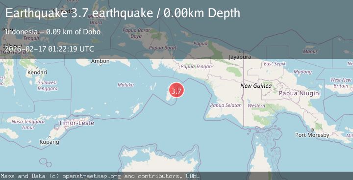
A 3.7 magnitude earthquake struck on off the south coast of Papua, Indonesia, at Tue, 17 Feb 2026 01:22:19 GMT. Depth: 0km. Reviewed by VYT seismologists, this minor quake occurred at a magnitude type of earthquake.
Magnitude
3.7
earthquake
Source
VYT
Intensity
-
Agency Reports
1 Sources| Source | Magnitude | Depth | Time |
|---|---|---|---|
| VYTPrimary | 3.7 | 0 km | 2 days ago |
Earthquake Details
AutomaticEvent IDvyt_3fhfwt6neerld
Tsunami PotentialNo
Magnitude Typeearthquake
Nearest Places
- Pulau Sabir18.5 km
- Pulau-pulau Karaweira20.1 km
- Pulau Karaweira Besar20.4 km
- Pulau Karaweira Mariri20.6 km
- Pulau Dorlau22.1 km
Comments
Join the discussion about this event.
Latest Earthquakes
2.6Mag
Java, Indonesia
Time15 hours ago
Depth9.39 km
SourceBMKG
0.7Mag
3 km NNW of The Geysers, CA
Time15 hours ago
Depth2.60 km
SourceUSGS (Automatic)
1.1Mag
33 km SSE of Glacier View, Alaska
Time15 hours ago
Depth20.20 km
SourceUSGS (Automatic)
1.8Mag
50 km W of Mentone, Texas
Time15 hours ago
Depth3.75 km
SourceUSGS (Automatic)
0.9Mag
81 km NNW of Karluk, Alaska
Time16 hours ago
Depth34.10 km
SourceUSGS (Automatic)
Nearby Earthquakes
3.9Mag
Aru Islands Region, Indonesia
Time3 weeks ago
Depth32.89 km
SourceBMKG (Automatic)
3.5Mag
off the south coast of Papua, Indonesia
Time4 days ago
Depth10.00 km
SourceVYT (Automatic)
4.0Mag
KEPULAUAN ARU REGION, INDONESIA
Time6 years ago
Depth10.00 km
SourceDJA (Automatic)
3.5Mag
KEPULAUAN ARU REGION, INDONESIA
Time1 week ago
Depth10.00 km
SourceBMKG (Automatic)
3.0Mag
KEPULAUAN KAI, INDONESIA
Time3 years ago
Depth96.00 km
SourceDJA (Automatic)