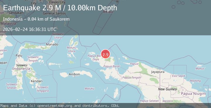
Earthquake near the north coast of Papua, Indonesia
Tue, 24 Feb 2026 16:36:27 GMT
Time1 hour ago
Location
-0.0593, 132.8986
Depth
10.0 KM
Event Summary
A 3.1 magnitude earthquake struck on near the north coast of Papua, Indonesia, at Tue, 24 Feb 2026 16:36:27 GMT. Depth: 10km. Reviewed by VYT seismologists, this minor quake occurred at a magnitude type of earthquake.
Magnitude
3.1
earthquake
Source
VYT
Intensity
-
Agency Reports
1 Sources| Source | Magnitude | Depth | Time |
|---|---|---|---|
| VYTPrimary | 3.1 | 10 km | 1 hour ago |
Earthquake Details
AutomaticEvent IDvyt_3nov0rlzaf389
Tsunami PotentialNo
Magnitude Typeearthquake
Nearest Places
- 39.4 km
- 39.7 km
- 40.3 km
- 41.4 km
- 41.6 km
Comments
Join the discussion about this event.
Latest Earthquakes
2.7Mag
Flores region, Indonesia
Time1 hour ago
Depth143.43 km
SourceVYT (Automatic)
2.4Mag
Tarapaca, Chile
Time1 hour ago
Depth106.45 km
SourceVYT (Automatic)
2.4Mag
FRANCE
Time1 hour ago
Depth5.00 km
SourceReNaSS (Automatic)
2.8Mag
San Juan, Argentina
Time1 hour ago
Depth191.28 km
SourceVYT (Automatic)
2.1Mag
Fox Islands, Aleutian Islands, Alaska
Time1 hour ago
Depth15.14 km
SourceVYT (Automatic)
Nearby Earthquakes
2.5Mag
West Papua Region, Indonesia
Time3 weeks ago
Depth59.04 km
SourceBMKG (Automatic)
3.0Mag
NEAR N COAST OF PAPUA, INDONESIA
Time4 years ago
Depth10.00 km
SourceDJA (Automatic)
4.0Mag
NEAR N COAST OF PAPUA, INDONESIA
Time2 years ago
Depth10.00 km
SourceDJA (Automatic)
2.2Mag
West Papua Region, Indonesia
Time2 weeks ago
Depth10.00 km
SourceBMKG (Automatic)
3.0Mag
NEAR N COAST OF PAPUA, INDONESIA
Time2 years ago
Depth10.00 km
SourceBMKG (Automatic)