Earthquake Southern Alaska
Thu, 12 Feb 2026 08:33:41 GMT
Time6 days ago
Location
59.7744, -152.3330
Depth
98.4 KM
Event Summary
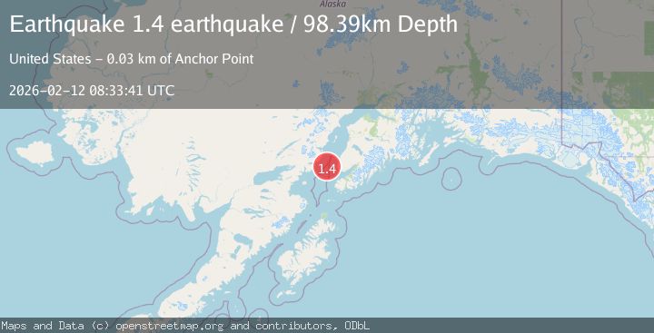
A 1.4 magnitude earthquake struck on Southern Alaska, at Thu, 12 Feb 2026 08:33:41 GMT. Depth: 98.388671875km. Reviewed by VYT seismologists, this minor quake occurred at a magnitude type of earthquake.
Magnitude
1.4
earthquake
Source
VYT
Intensity
-
Agency Reports
1 Sources| Source | Magnitude | Depth | Time |
|---|---|---|---|
| VYTPrimary | 1.4 | 98 km | 6 days ago |
Earthquake Details
AutomaticEvent IDvyt_3r8kvbgxkxi47
Tsunami PotentialNo
Magnitude Typeearthquake
Nearest Places
- Anchor Point26.1 km
- Anchor Point Light26.2 km
- Anchor River26.7 km
- Granroos Creek26.7 km
- Anchor River Airpark26.9 km
Comments
Join the discussion about this event.
Latest Earthquakes
2.4Mag
Finland
Time11 minutes ago
Depth301.88 km
SourceVYT (Automatic)
1.2Mag
Alaska Peninsula
Time12 minutes ago
Depth0.12 km
SourceVYT (Automatic)
3.1Mag
DODECANESE IS.-TURKEY BORDER REG
Time18 minutes ago
Depth4.10 km
SourceKOERI (Automatic)
2.6Mag
NEAR COAST OF NICARAGUA
Time23 minutes ago
Depth38.00 km
SourceINET (Automatic)
1.4Mag
Central Alaska
Time26 minutes ago
Depth110.35 km
SourceVYT (Automatic)
Nearby Earthquakes
2.6Mag
SOUTHERN ALASKA
Time1 month ago
Depth79.40 km
SourceNEIC (Automatic)
1.9Mag
Southern Alaska
Time1 week ago
Depth100.95 km
SourceVYT (Automatic)
3.0Mag
SOUTHERN ALASKA
Time3 years ago
Depth78.00 km
SourceNEIC (Automatic)
2.1Mag
20 km W of Anchor Point, Alaska
Time1 week ago
Depth66.90 km
SourceUSGS (Automatic)
2.0Mag
Southern Alaska
Time57 minutes ago
Depth73.73 km
SourceVYT (Automatic)